La Voulte-sur-Rhône (La Voulte-sur-Rhône)
- commune in Ardèche, France
- Country:

- Postal Code: 07800
- Coordinates: 44° 47' 58" N, 4° 46' 45" E


- GPS tracks (wikiloc): [Link]
- AboveSeaLevel: 98 м m
- Area: 9.7 sq km
- Population: 5109
- Web site: http://www.lavoultesurrhone.fr
- Wikipedia en: wiki(en)
- Wikipedia: wiki(fr)
- Wikidata storage: Wikidata: Q325192
- Wikipedia Commons Category: [Link]
- Freebase ID: [/m/03m8kzn]
- GeoNames ID: Alt: [3005435]
- SIREN number: [210703492]
- BnF ID: [122479839]
- VIAF ID: Alt: [157170238]
- GND ID: Alt: [4324164-5]
- Library of Congress authority ID: Alt: [n85137422]
- MusicBrainz area ID: [14e4e02f-cdc5-4111-9de9-f8b1d3e03e2a]
- INSEE municipality code: 07349
Shares border with regions:

Beauchastel
- commune in Ardèche, France
 Hiking in Beauchastel
Beauchastel is a charming village located in the Auvergne-Rhône-Alpes region of France, nestled along the Rhône River. The area surrounding Beauchastel offers a variety of hiking opportunities, allowing you to experience beautiful landscapes, enchanting natural scenery, and an array of flora and fauna....
- Country:
- Postal Code: 07800
- Coordinates: 44° 49' 33" N, 4° 48' 11" E
- GPS tracks (wikiloc): [Link]
- Area: 8.46 sq km
- Population: 1815
- Web site: [Link]

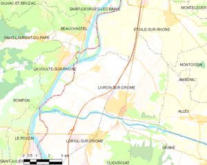
Livron-sur-Drôme
- commune in Drôme, France
Hiking in Livron-sur-Drôme
Livron-sur-Drôme, located in the Auvergne-Rhône-Alpes region of southeastern France, offers a charming landscape for hiking enthusiasts. Nestled along the banks of the Drôme River, the area boasts a combination of natural beauty, cultural heritage, and varied terrains, making it an excellent destination for both casual walkers and more experienced hikers....
- Country:
- Postal Code: 26250
- Coordinates: 44° 46' 22" N, 4° 50' 35" E
- GPS tracks (wikiloc): [Link]
- Area: 39.52 sq km
- Population: 8910
- Web site: [Link]

Rompon
- commune in Ardèche, France
- Country:
- Postal Code: 07250
- Coordinates: 44° 45' 41" N, 4° 43' 24" E
- GPS tracks (wikiloc): [Link]
- Area: 22.03 sq km
- Population: 1053

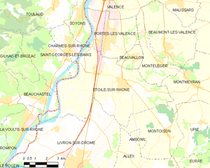
Étoile-sur-Rhône
- commune in Drôme, France
Hiking in Étoile-sur-Rhône
Étoile-sur-Rhône is a charming commune located in the Drôme department of southeastern France. Surrounded by the picturesque landscapes of the Rhône Valley, it serves as a great starting point for various hiking adventures....
- Country:
- Postal Code: 26800
- Coordinates: 44° 50' 13" N, 4° 53' 38" E
- GPS tracks (wikiloc): [Link]
- Area: 42.79 sq km
- Population: 5347
- Web site: [Link]

Saint-Laurent-du-Pape
- commune in Ardèche, France
- Country:
- Postal Code: 07800
- Coordinates: 44° 49' 24" N, 4° 46' 0" E
- GPS tracks (wikiloc): [Link]
- Area: 20.1 sq km
- Population: 1562