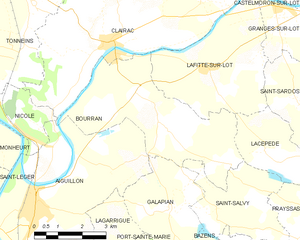
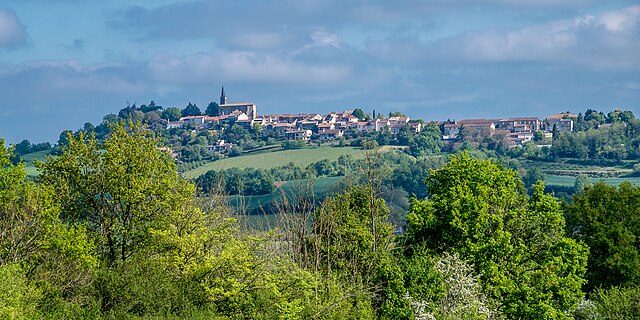
Lacépède (Lacépède)

- commune in Lot-et-Garonne, France
- Country:

- Postal Code: 47360
- Coordinates: 44° 19' 18" N, 0° 27' 43" E


- GPS tracks (wikiloc): [Link]
- Area: 11.33 sq km
- Population: 327
- Web site: http://www.lacepede.com
- Wikipedia en: wiki(en)
- Wikipedia: wiki(fr)
- Wikidata storage: Wikidata: Q738315
- Wikipedia Commons Category: [Link]
- Freebase ID: [/m/03qk0c7]
- GeoNames ID: Alt: [6434970]
- SIREN number: [214701252]
- BnF ID: [152612069]
- VIAF ID: Alt: [292977597]
- SUDOC authorities ID: [166043818]
- INSEE municipality code: 47125
Shares border with regions:

Bourran
- commune in Lot-et-Garonne, France
- Country:
- Postal Code: 47320
- Coordinates: 44° 20' 33" N, 0° 23' 37" E
- GPS tracks (wikiloc): [Link]
- Area: 18.16 sq km
- Population: 607


Saint-Sardos
- commune in Lot-et-Garonne, France
- Country:
- Postal Code: 47360
- Coordinates: 44° 20' 27" N, 0° 28' 40" E
- GPS tracks (wikiloc): [Link]
- Area: 14.46 sq km
- Population: 291

Montpezat
- commune in Lot-et-Garonne, France
- Country:
- Postal Code: 47360
- Coordinates: 44° 20' 48" N, 0° 31' 26" E
- GPS tracks (wikiloc): [Link]
- Area: 24.19 sq km
- Population: 579
Lafitte-sur-Lot
- commune in Lot-et-Garonne, France
- Country:
- Postal Code: 47320
- Coordinates: 44° 21' 6" N, 0° 25' 53" E
- GPS tracks (wikiloc): [Link]
- AboveSeaLevel: 50 м m
- Area: 15.99 sq km
- Population: 834
- Web site: [Link]


Saint-Salvy
- commune in Lot-et-Garonne, France
- Country:
- Postal Code: 47360
- Coordinates: 44° 17' 59" N, 0° 26' 17" E
- GPS tracks (wikiloc): [Link]
- Area: 9.26 sq km
- Population: 189


Prayssas
- commune in Lot-et-Garonne, France
- Country:
- Postal Code: 47360
- Coordinates: 44° 17' 16" N, 0° 30' 32" E
- GPS tracks (wikiloc): [Link]
- Area: 26.48 sq km
- Population: 997