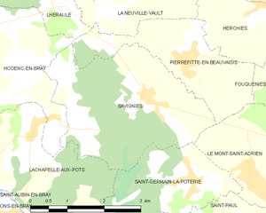
Lachapelle-aux-Pots (Lachapelle-aux-Pots)
- commune in Oise, France
- Country:

- Postal Code: 60650
- Coordinates: 49° 26' 57" N, 1° 54' 9" E


- GPS tracks (wikiloc): [Link]
- Area: 9.85 sq km
- Population: 1605
- Web site: http://www.mairie-lachapelleauxpots-oise.fr
- Wikipedia en: wiki(en)
- Wikipedia: wiki(fr)
- Wikidata storage: Wikidata: Q1337919
- Wikipedia Commons Category: [Link]
- Freebase ID: [/m/03qg69j]
- GeoNames ID: Alt: [6438771]
- SIREN number: [216003301]
- BnF ID: [152675711]
- MusicBrainz area ID: [7174079b-83f2-4cc6-b213-c61ee283377c]
- INSEE municipality code: 60333
Shares border with regions:


Savignies
- commune in Oise, France
- Country:

- Postal Code: 60650
- Coordinates: 49° 27' 54" N, 1° 57' 52" E


- GPS tracks (wikiloc): [Link]
- Area: 9.83 sq km
- Population: 824


Hodenc-en-Bray
- commune in Oise, France
- Country:

- Postal Code: 60650
- Coordinates: 49° 28' 2" N, 1° 53' 53" E


- GPS tracks (wikiloc): [Link]
- Area: 9.94 sq km
- Population: 494


Saint-Germain-la-Poterie
- commune in Oise, France
- Country:

- Postal Code: 60650
- Coordinates: 49° 26' 44" N, 1° 58' 57" E


- GPS tracks (wikiloc): [Link]
- Area: 6.02 sq km
- Population: 429


Saint-Paul
- commune in Oise, France
- Country:

- Postal Code: 60650
- Coordinates: 49° 25' 45" N, 2° 0' 25" E


- GPS tracks (wikiloc): [Link]
- Area: 9.52 sq km
- Population: 1536


Blacourt
- commune in Oise, France
- Country:

- Postal Code: 60650
- Coordinates: 49° 27' 45" N, 1° 51' 29" E


- GPS tracks (wikiloc): [Link]
- Area: 11.49 sq km
- Population: 658


Saint-Aubin-en-Bray
- commune in Oise, France
- Country:

- Postal Code: 60650
- Coordinates: 49° 25' 11" N, 1° 52' 42" E


- GPS tracks (wikiloc): [Link]
- Area: 6.38 sq km
- Population: 1125


Ons-en-Bray
- commune in Oise, France
- Country:

- Postal Code: 60650
- Coordinates: 49° 24' 59" N, 1° 55' 23" E


- GPS tracks (wikiloc): [Link]
- Area: 13.95 sq km
- Population: 1405
