Ladignac-sur-Rondelles (Ladignac-sur-Rondelles)

- commune in Corrèze, France
- Country:

- Postal Code: 19150
- Coordinates: 45° 14' 1" N, 1° 50' 16" E


- GPS tracks (wikiloc): [Link]
- AboveSeaLevel: 450 м m
- Area: 10.18 sq km
- Population: 417
- Wikipedia en: wiki(en)
- Wikipedia: wiki(fr)
- Wikidata storage: Wikidata: Q181330
- Wikipedia Commons Category: [Link]
- Freebase ID: [/m/03mfzfs]
- GeoNames ID: Alt: [6447548]
- SIREN number: [211909601]
- BnF ID: [15249732r]
- INSEE municipality code: 19096
Shares border with regions:


Lagarde-Enval
- commune in Corrèze, France
- Country:
- Postal Code: 19150
- Coordinates: 45° 11' 13" N, 1° 48' 27" E
- GPS tracks (wikiloc): [Link]
- Area: 21.55 sq km
- Population: 814


Espagnac
- commune in Corrèze, France
- Country:
- Postal Code: 19150
- Coordinates: 45° 13' 48" N, 1° 53' 48" E
- GPS tracks (wikiloc): [Link]
- Area: 23.63 sq km
- Population: 371


Pandrignes
- commune in Corrèze, France
- Country:
- Postal Code: 19150
- Coordinates: 45° 13' 42" N, 1° 51' 16" E
- GPS tracks (wikiloc): [Link]
- Area: 8.45 sq km
- Population: 162


Marc-la-Tour
- commune in Corrèze, France
- Country:
- Postal Code: 19150
- Coordinates: 45° 12' 18" N, 1° 50' 41" E
- GPS tracks (wikiloc): [Link]
- Area: 6.59 sq km
- Population: 160

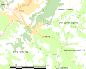
Laguenne
- commune in Corrèze, France
- Country:
- Postal Code: 19150
- Coordinates: 45° 14' 32" N, 1° 46' 53" E
- GPS tracks (wikiloc): [Link]
- Area: 7.01 sq km
- Population: 1327
- Web site: [Link]


Saint-Bonnet-Avalouze
- commune in Corrèze, France
- Country:
- Postal Code: 19150
- Coordinates: 45° 15' 22" N, 1° 49' 55" E
- GPS tracks (wikiloc): [Link]
- AboveSeaLevel: 300 м m
- Area: 5.14 sq km
- Population: 221


Sainte-Fortunade
- commune in Corrèze, France
- Country:
- Postal Code: 19490
- Coordinates: 45° 12' 25" N, 1° 46' 16" E
- GPS tracks (wikiloc): [Link]
- Area: 38.31 sq km
- Population: 1794
- Web site: [Link]