Lahontan (Lahontan)

- commune in Pyrénées-Atlantiques, France
- Country:

- Postal Code: 64270
- Coordinates: 43° 31' 49" N, 0° 58' 3" E


- GPS tracks (wikiloc): [Link]
- Area: 14.64 sq km
- Population: 494
- Web site: http://www.lahontan.fr
- Wikipedia en: wiki(en)
- Wikipedia: wiki(fr)
- Wikidata storage: Wikidata: Q682394
- Wikipedia Commons Category: [Link]
- Freebase ID: [/m/03qlv9k]
- Freebase ID: [/m/03qlv9k]
- GeoNames ID: Alt: [6440446]
- GeoNames ID: Alt: [6440446]
- SIREN number: [216403055]
- SIREN number: [216403055]
- BnF ID: [15270127z]
- BnF ID: [15270127z]
- Quora topic ID: [Lahontan]
- Quora topic ID: [Lahontan]
- INSEE municipality code: 64305
- INSEE municipality code: 64305
Shares border with regions:


Habas
- commune in Landes, France
- Country:
- Postal Code: 40290
- Coordinates: 43° 34' 18" N, 0° 55' 46" E
- GPS tracks (wikiloc): [Link]
- Area: 18.75 sq km
- Population: 1512


Sorde-l'Abbaye
- commune in Landes, France
- Country:
- Postal Code: 40300
- Coordinates: 43° 31' 44" N, 1° 3' 14" E
- GPS tracks (wikiloc): [Link]
- Area: 16.34 sq km
- Population: 648


Puyoô
- commune in Pyrénées-Atlantiques, France
- Country:
- Postal Code: 64270
- Coordinates: 43° 31' 30" N, 0° 54' 46" E
- GPS tracks (wikiloc): [Link]
- Area: 9.32 sq km
- Population: 1154
Carresse-Cassaber
- commune in Pyrénées-Atlantiques, France
- Country:
- Postal Code: 64270
- Coordinates: 43° 28' 41" N, 0° 59' 43" E
- GPS tracks (wikiloc): [Link]
- AboveSeaLevel: 53 м m
- Area: 13.91 sq km
- Population: 659
- Web site: [Link]


Labatut
- commune in Landes, France
- Country:
- Postal Code: 40300
- Coordinates: 43° 33' 1" N, 0° 59' 7" E
- GPS tracks (wikiloc): [Link]
- AboveSeaLevel: 46 м m
- Area: 20.95 sq km
- Population: 1421
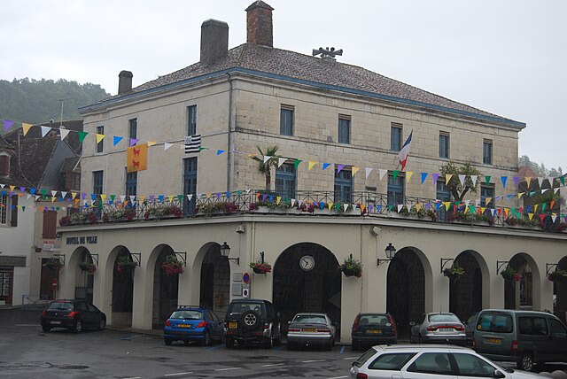
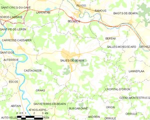
Salies-de-Béarn
- commune in Pyrénées-Atlantiques, France
- Country:
- Postal Code: 64270
- Coordinates: 43° 28' 15" N, 0° 55' 35" E
- GPS tracks (wikiloc): [Link]
- Area: 52.08 sq km
- Population: 4741
- Web site: [Link]


Bellocq
- commune in Pyrénées-Atlantiques, France
- Country:
- Postal Code: 64270
- Coordinates: 43° 31' 0" N, 0° 54' 57" E
- GPS tracks (wikiloc): [Link]
- Area: 12.65 sq km
- Population: 892

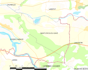
Saint-Cricq-du-Gave
- commune in Landes, France
- Country:
- Postal Code: 40300
- Coordinates: 43° 32' 1" N, 1° 0' 47" E
- GPS tracks (wikiloc): [Link]
- Area: 8.7 sq km
- Population: 412