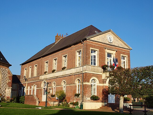
Lalande-en-Son (Lalande-en-Son)

- commune in Oise, France
- Country:

- Postal Code: 60590
- Coordinates: 49° 23' 28" N, 1° 46' 54" E


- GPS tracks (wikiloc): [Link]
- Area: 5.99 sq km
- Population: 677
- Wikipedia en: wiki(en)
- Wikipedia: wiki(fr)
- Wikidata storage: Wikidata: Q1337086
- Wikipedia Commons Category: [Link]
- Freebase ID: [/m/03qg6j1]
- GeoNames ID: Alt: [6438779]
- SIREN number: [216003400]
- BnF ID: [15267581b]
- INSEE municipality code: 60343
Shares border with regions:

Le Coudray-Saint-Germer
- commune in Oise, France
- Country:
- Postal Code: 60850
- Coordinates: 49° 24' 43" N, 1° 50' 13" E
- GPS tracks (wikiloc): [Link]
- Area: 13.48 sq km
- Population: 951


Puiseux-en-Bray
- commune in Oise, France
- Country:
- Postal Code: 60850
- Coordinates: 49° 24' 55" N, 1° 47' 0" E
- GPS tracks (wikiloc): [Link]
- Area: 8.01 sq km
- Population: 422

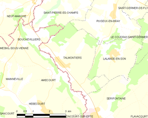
Talmontiers
- commune in Oise, France
- Country:
- Postal Code: 60590
- Coordinates: 49° 23' 11" N, 1° 44' 20" E
- GPS tracks (wikiloc): [Link]
- Area: 9.23 sq km
- Population: 690


Sérifontaine
- commune in Oise, France
- Country:
- Postal Code: 60590
- Coordinates: 49° 21' 12" N, 1° 46' 13" E
- GPS tracks (wikiloc): [Link]
- Area: 20.43 sq km
- Population: 2812
- Web site: [Link]