Laleu (Laleu)

- commune in Orne, France
- Country:

- Postal Code: 61170
- Coordinates: 48° 33' 5" N, 0° 22' 45" E


- GPS tracks (wikiloc): [Link]
- Area: 11.41 sq km
- Population: 364
- Wikipedia en: wiki(en)
- Wikipedia: wiki(fr)
- Wikidata storage: Wikidata: Q212358
- Wikipedia Commons Category: [Link]
- Freebase ID: [/m/03x_ykq]
- Freebase ID: [/m/03x_ykq]
- GeoNames ID: Alt: [6439122]
- GeoNames ID: Alt: [6439122]
- SIREN number: [216102152]
- SIREN number: [216102152]
- BnF ID: [152681479]
- BnF ID: [152681479]
- INSEE municipality code: 61215
- INSEE municipality code: 61215
Shares border with regions:


Saint-Aubin-d'Appenai
- commune in Orne, France
- Country:
- Postal Code: 61170
- Coordinates: 48° 32' 8" N, 0° 20' 26" E
- GPS tracks (wikiloc): [Link]
- Area: 11.29 sq km
- Population: 396


Coulonges-sur-Sarthe
- commune in Orne, France
- Country:
- Postal Code: 61170
- Coordinates: 48° 31' 54" N, 0° 23' 59" E
- GPS tracks (wikiloc): [Link]
- Area: 9.65 sq km
- Population: 535

Montchevrel
- commune in Orne, France
- Country:
- Postal Code: 61170
- Coordinates: 48° 34' 23" N, 0° 20' 21" E
- GPS tracks (wikiloc): [Link]
- Area: 10.8 sq km
- Population: 236

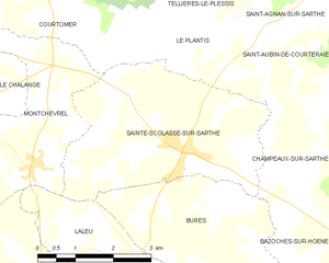
Sainte-Scolasse-sur-Sarthe
- commune in Orne, France
- Country:
- Postal Code: 61170
- Coordinates: 48° 34' 39" N, 0° 23' 32" E
- GPS tracks (wikiloc): [Link]
- Area: 13.88 sq km
- Population: 624


Bures
- commune in Orne, France
- Country:
- Postal Code: 61170
- Coordinates: 48° 33' 48" N, 0° 24' 5" E
- GPS tracks (wikiloc): [Link]
- Area: 9.64 sq km
- Population: 167