Langouet (Langouet)

- commune in Ille-et-Vilaine, France
- Country:

- Postal Code: 35630
- Coordinates: 48° 14' 59" N, 1° 49' 23" E


- GPS tracks (wikiloc): [Link]
- Area: 6.99 sq km
- Population: 600
- Web site: http://www.langouet.fr
- Wikipedia en: wiki(en)
- Wikipedia: wiki(fr)
- Wikidata storage: Wikidata: Q193629
- Wikipedia Commons Category: [Link]
- Freebase ID: [/m/03mbb7d]
- Freebase ID: [/m/03mbb7d]
- GeoNames ID: Alt: [6432726]
- GeoNames ID: Alt: [6432726]
- SIREN number: [213501463]
- SIREN number: [213501463]
- BnF ID: [15257090q]
- BnF ID: [15257090q]
- VIAF ID: Alt: [246953930]
- VIAF ID: Alt: [246953930]
- OSM relation ID: [134219]
- OSM relation ID: [134219]
- INSEE municipality code: 35146
- INSEE municipality code: 35146
Shares border with regions:


Saint-Gondran
- commune in Ille-et-Vilaine, France
- Country:
- Postal Code: 35630
- Coordinates: 48° 16' 1" N, 1° 50' 8" E
- GPS tracks (wikiloc): [Link]
- Area: 4.4 sq km
- Population: 535


Vignoc
- commune in Ille-et-Vilaine, France
- Country:
- Postal Code: 35630
- Coordinates: 48° 14' 56" N, 1° 46' 56" E
- GPS tracks (wikiloc): [Link]
- Area: 14.09 sq km
- Population: 1831
- Web site: [Link]

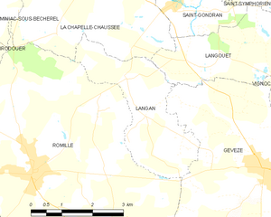
Langan
- commune in Ille-et-Vilaine, France
- Country:
- Postal Code: 35850
- Coordinates: 48° 14' 40" N, 1° 51' 13" E
- GPS tracks (wikiloc): [Link]
- Area: 7.8 sq km
- Population: 917
- Web site: [Link]


Gévezé
- commune in Ille-et-Vilaine, France
- Country:
- Postal Code: 35850
- Coordinates: 48° 13' 9" N, 1° 47' 17" E
- GPS tracks (wikiloc): [Link]
- Area: 27.54 sq km
- Population: 5161
- Web site: [Link]


La Chapelle-Chaussée
- commune in Ille-et-Vilaine, France
- Country:
- Postal Code: 35630
- Coordinates: 48° 16' 18" N, 1° 51' 17" E
- GPS tracks (wikiloc): [Link]
- Area: 14.76 sq km
- Population: 1254
- Web site: [Link]

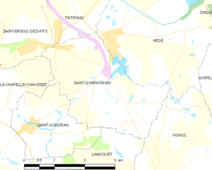
Saint-Symphorien
- commune in Ille-et-Vilaine, France
- Country:
- Postal Code: 35630
- Coordinates: 48° 17' 33" N, 1° 49' 18" E
- GPS tracks (wikiloc): [Link]
- Area: 7.91 sq km
- Population: 638