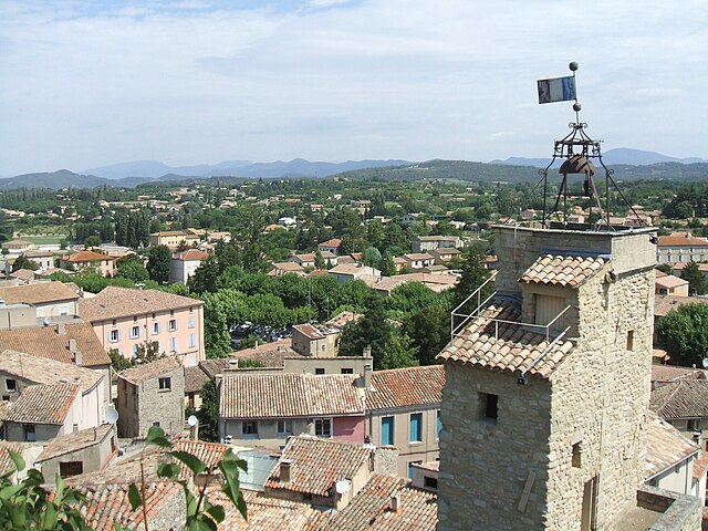
Le Barroux (Le Barroux)

- commune in Vaucluse, France
 Hiking in Le Barroux
Le Barroux is a delightful village located in the Vaucluse region of Provence, France, known for its stunning landscapes, historical sites, and trails that cater to hikers of various skill levels. Here are some highlights for hiking in and around Le Barroux:
Scenic Trails
-
Mont Ventoux: As a prominent landmark near Le Barroux, Mont Ventoux offers several trails ranging from easy walks to challenging hikes. The panoramic views from the summit are breathtaking, especially on clear days when you can see the surrounding vineyards and mountains.
-
GR4 Trail: This long-distance trail runs through the region and offers stunning views of the landscape. You can access segments of the GR4 from Le Barroux, allowing for multi-day hiking experiences.
-
Local Heritage Trails: Explore the historical and cultural heritage of Le Barroux by following trails that take you past local landmarks, such as the Château du Barroux, which dates back to the 12th century.
Flora and Fauna
The region is rich in biodiversity, with various walking paths that meander through vineyards, orchards, and forests. Keep an eye out for native Mediterranean plants, birds, and wildlife, making your hike a rewarding experience for nature lovers.
Preparing for Your Hike
- Difficulty Levels: Trails range from easy to challenging, so it's advisable to assess your fitness level and choose a trail that aligns with your abilities.
- Weather Conditions: Be mindful of the weather, especially in summer when temperatures can soar. Early morning hikes are ideal to avoid the heat.
- Gear: Comfortable hiking shoes, sun protection, and plenty of water are essential for a safe and enjoyable hiking experience.
Local Tips
- Guided Hikes: Consider joining a guided hiking tour that often provides insights into local culture, history, and geology.
- Seasonal Considerations: Spring and fall are particularly pleasant for hiking due to mild temperatures and fewer tourists.
Access
Le Barroux is accessible by car, and there are parking facilities available. Public transportation options may be limited, so checking local schedules beforehand is advisable.
Exploring the hiking opportunities in Le Barroux offers an excellent way to experience the natural beauty and historical charm of the Provence region. Enjoy your hike!
- Country:

- Postal Code: 84330
- Coordinates: 44° 8' 13" N, 5° 5' 59" E


- GPS tracks (wikiloc): [Link]
- Area: 16.04 sq km
- Population: 650
- Web site: http://www.mairie-lebarroux.fr
- Wikipedia en: wiki(en)
- Wikipedia: wiki(fr)
- Wikidata storage: Wikidata: Q273943
- Wikipedia Commons Gallery: [Link]
- Wikipedia Commons Category: [Link]
- Freebase ID: [/m/0c3bhy]
- GeoNames ID: Alt: [3005359]
- SIREN number: [218400083]
- BnF ID: [152779882]
- VIAF ID: Alt: [243061933]
- GND ID: Alt: [4222351-9]
- MusicBrainz area ID: [163f8723-100f-44b1-9d08-8b60923d0310]
- INSEE municipality code: 84008
Shares border with regions:


Suzette
- commune in Vaucluse, France
Hiking in Suzette
Suzette, located in the Vaucluse department of France, is a charming village nestled at the foot of the Dentelles de Montmirail mountain range. The area is known for its stunning landscapes, vineyards, and diverse hiking trails suitable for different skill levels....
- Country:
- Postal Code: 84190
- Coordinates: 44° 10' 5" N, 5° 4' 6" E
- GPS tracks (wikiloc): [Link]
- Area: 6.75 sq km
- Population: 126

Malaucène
- commune in Vaucluse, France
Hiking in Malaucène
Malaucène is a charming village located in the Vaucluse department of the Provence-Alpes-Côte d'Azur region in southern France. It is nestled at the foot of Mont Ventoux, one of the most famous peaks in the region, which offers a wide range of hiking opportunities for both novice and experienced hikers....
- Country:
- Postal Code: 84340
- Coordinates: 44° 10' 27" N, 5° 7' 56" E
- GPS tracks (wikiloc): [Link]
- Area: 45.33 sq km
- Population: 2849
- Web site: [Link]


La Roque-Alric
- commune in Vaucluse, France
Hiking in La Roque-Alric
La Roque-Alric is a charming village located in the Vaucluse department in the Provence-Alpes-Côte d'Azur region of France. It's set against a backdrop of stunning cliffs and vineyards, making it a scenic destination for hiking enthusiasts. Here are some points to consider if you’re planning to hike in and around La Roque-Alric:...
- Country:
- Postal Code: 84190
- Coordinates: 44° 8' 35" N, 5° 3' 51" E
- GPS tracks (wikiloc): [Link]
- Area: 4.87 sq km
- Population: 51

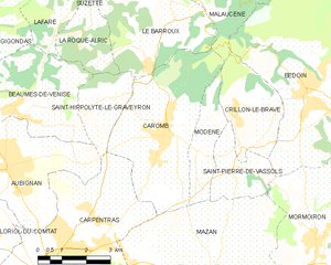
Caromb
- commune in Vaucluse, France
Hiking in Caromb
Caromb is a charming village located in the Vaucluse region of Provence, France, surrounded by a stunning natural landscape that makes it a great spot for hiking enthusiasts. The area offers a mix of gentle slopes, vineyards, and breathtaking views of the Mont Ventoux mountain, which is a popular destination for outdoor activities....
- Country:
- Postal Code: 84330
- Coordinates: 44° 6' 40" N, 5° 6' 28" E
- GPS tracks (wikiloc): [Link]
- Area: 17.98 sq km
- Population: 3249
- Web site: [Link]

Saint-Hippolyte-le-Graveyron
- commune in Vaucluse, France
Hiking in Saint-Hippolyte-le-Graveyron
Saint-Hippolyte-le-Graveyron is a charming commune located in the Vaucluse department of the Provence-Alpes-Côte d'Azur region in southeastern France. It is known for its beautiful landscapes, serene atmosphere, and proximity to several natural and cultural attractions, making it an appealing destination for hikers and outdoor enthusiasts....
- Country:
- Postal Code: 84330
- Coordinates: 44° 7' 22" N, 5° 4' 28" E
- GPS tracks (wikiloc): [Link]
- AboveSeaLevel: 170 м m
- Area: 4.94 sq km
- Population: 182