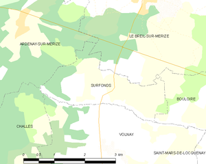
Le Breil-sur-Mérize (Le Breil-sur-Mérize)

- commune in Sarthe, France
- Country:

- Postal Code: 72370
- Coordinates: 48° 0' 29" N, 0° 28' 36" E


- GPS tracks (wikiloc): [Link]
- Area: 18.35 sq km
- Population: 1539
- Web site: http://www.lebreilsurmerize.fr
- Wikipedia en: wiki(en)
- Wikipedia: wiki(fr)
- Wikidata storage: Wikidata: Q203114
- Wikipedia Commons Category: [Link]
- Freebase ID: [/m/03qkzbs]
- GeoNames ID: Alt: [6457048]
- SIREN number: [217200468]
- BnF ID: [15273604d]
- INSEE municipality code: 72046
Shares border with regions:


Soulitré
- commune in Sarthe, France
- Country:
- Postal Code: 72370
- Coordinates: 48° 0' 41" N, 0° 27' 21" E
- GPS tracks (wikiloc): [Link]
- Area: 10.99 sq km
- Population: 649
- Web site: [Link]


Ardenay-sur-Mérize
- commune in Sarthe, France
- Country:
- Postal Code: 72370
- Coordinates: 47° 59' 42" N, 0° 25' 29" E
- GPS tracks (wikiloc): [Link]
- Area: 11.67 sq km
- Population: 480
- Web site: [Link]

Surfonds
- commune in Sarthe, France
- Country:
- Postal Code: 72370
- Coordinates: 47° 58' 28" N, 0° 27' 41" E
- GPS tracks (wikiloc): [Link]
- Area: 4.85 sq km
- Population: 344
- Web site: [Link]


Saint-Michel-de-Chavaignes
- commune in Sarthe, France
- Country:
- Postal Code: 72440
- Coordinates: 48° 1' 6" N, 0° 34' 21" E
- GPS tracks (wikiloc): [Link]
- Area: 18.37 sq km
- Population: 750


Nuillé-le-Jalais
- commune in Sarthe, France
- Country:
- Postal Code: 72370
- Coordinates: 48° 1' 13" N, 0° 28' 53" E
- GPS tracks (wikiloc): [Link]
- Area: 5.82 sq km
- Population: 529


Bouloire
- commune in Sarthe, France
- Country:
- Postal Code: 72440
- Coordinates: 47° 58' 25" N, 0° 32' 57" E
- GPS tracks (wikiloc): [Link]
- Area: 26.77 sq km
- Population: 2077


Thorigné-sur-Dué
- commune in Sarthe, France
- Country:
- Postal Code: 72160
- Coordinates: 48° 2' 17" N, 0° 32' 11" E
- GPS tracks (wikiloc): [Link]
- Area: 18.99 sq km
- Population: 1599