Le May-sur-Èvre (Le May-sur-Èvre)

- commune in Maine-et-Loire, France
- Country:

- Postal Code: 49122
- Coordinates: 47° 8' 7" N, 0° 53' 34" E


- GPS tracks (wikiloc): [Link]
- Area: 31.62 sq km
- Population: 3845
- Web site: http://www.lemaysurevre.com
- Wikipedia en: wiki(en)
- Wikipedia: wiki(fr)
- Wikidata storage: Wikidata: Q1163305
- Wikipedia Commons Category: [Link]
- Freebase ID: [/m/03qcppx]
- GeoNames ID: Alt: [3003514]
- SIREN number: [214901936]
- BnF ID: [15261794s]
- VIAF ID: Alt: [133848063]
- GND ID: Alt: [7654205-1]
- Library of Congress authority ID: Alt: [n94056969]
- INSEE municipality code: 49193
Shares border with regions:


Bégrolles-en-Mauges
- commune in Maine-et-Loire, France
- Country:
- Postal Code: 49122
- Coordinates: 47° 8' 26" N, 0° 56' 29" E
- GPS tracks (wikiloc): [Link]
- Area: 14.62 sq km
- Population: 2012
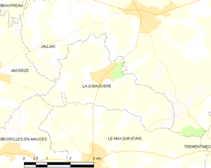
La Jubaudière
- former commune in Maine-et-Loire, France
- Country:
- Postal Code: 49510
- Coordinates: 47° 10' 20" N, 0° 53' 32" E
- GPS tracks (wikiloc): [Link]
- Area: 10.9 sq km
- Population: 1272


Trémentines
- commune in Maine-et-Loire, France
- Country:
- Postal Code: 49340
- Coordinates: 47° 7' 20" N, 0° 47' 11" E
- GPS tracks (wikiloc): [Link]
- Area: 34.06 sq km
- Population: 2912
- Web site: [Link]

Saint-Léger-sous-Cholet
- commune in Maine-et-Loire, France
- Country:
- Postal Code: 49280
- Coordinates: 47° 5' 35" N, 0° 54' 35" E
- GPS tracks (wikiloc): [Link]
- Area: 9.6 sq km
- Population: 2722
- Web site: [Link]


Jallais
- former commune in Maine-et-Loire, France
- Country:
- Postal Code: 49510
- Coordinates: 47° 11' 49" N, 0° 52' 8" E
- GPS tracks (wikiloc): [Link]
- Area: 52.81 sq km
- Population: 3347
- Web site: [Link]


Cholet
- commune in Maine-et-Loire, France
- Country:
- Postal Code: 49300
- Coordinates: 47° 3' 32" N, 0° 52' 47" E
- GPS tracks (wikiloc): [Link]
- AboveSeaLevel: 124 м m
- Area: 87.47 sq km
- Population: 53800
- Web site: [Link]