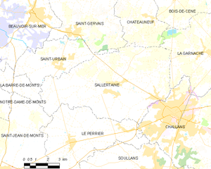
Le Perrier (Le Perrier)

- commune in Vendée, France
- Country:

- Postal Code: 85300
- Coordinates: 46° 49' 12" N, 1° 59' 35" E


- GPS tracks (wikiloc): [Link]
- Area: 33.22 sq km
- Population: 1954
- Web site: http://www.leperrier.fr
- Wikipedia en: wiki(en)
- Wikipedia: wiki(fr)
- Wikidata storage: Wikidata: Q1744223
- Wikipedia Commons Category: [Link]
- Freebase ID: [/m/03qltwg]
- GeoNames ID: Alt: [3002961]
- SIREN number: [218501724]
- BnF ID: [15278298p]
- VIAF ID: Alt: [123612827]
- GND ID: Alt: [4331911-7]
- Library of Congress authority ID: Alt: [nr95039604]
- INSEE municipality code: 85172
Shares border with regions:


Soullans
- commune in Vendée, France
- Country:
- Postal Code: 85300
- Coordinates: 46° 47' 45" N, 1° 54' 0" E
- GPS tracks (wikiloc): [Link]
- Area: 41.09 sq km
- Population: 4220
- Web site: [Link]


Saint-Hilaire-de-Riez
- commune in Vendée, France
- Country:
- Postal Code: 85270
- Coordinates: 46° 42' 47" N, 1° 55' 33" E
- GPS tracks (wikiloc): [Link]
- Area: 48.85 sq km
- Population: 11222
- Web site: [Link]

Sallertaine
- commune in Vendée, France
- Country:
- Postal Code: 85300
- Coordinates: 46° 51' 37" N, 1° 57' 19" E
- GPS tracks (wikiloc): [Link]
- Area: 49.45 sq km
- Population: 3036
- Web site: [Link]


Challans
- commune in Vendée, France
- Country:
- Postal Code: 85300
- Coordinates: 46° 50' 45" N, 1° 52' 45" E
- GPS tracks (wikiloc): [Link]
- Area: 64.84 sq km
- Population: 20133
- Web site: [Link]


Saint-Jean-de-Monts
- commune in Vendée, France
- Country:
- Postal Code: 85160
- Coordinates: 46° 47' 34" N, 2° 3' 37" E
- GPS tracks (wikiloc): [Link]
- Area: 61.72 sq km
- Population: 8621
- Web site: [Link]