Le Pouzin (Le Pouzin)
- commune in Ardèche, France
- Country:

- Postal Code: 07250
- Coordinates: 44° 45' 12" N, 4° 44' 52" E


- GPS tracks (wikiloc): [Link]
- Area: 12.52 sq km
- Population: 2835
- Wikipedia en: wiki(en)
- Wikipedia: wiki(fr)
- Wikidata storage: Wikidata: Q625492
- Wikipedia Commons Category: [Link]
- Freebase ID: [/m/03m8js4]
- GeoNames ID: Alt: [3002520]
- SIREN number: [210701819]
- BnF ID: [119690724]
- VIAF ID: Alt: [158317989]
- Library of Congress authority ID: Alt: [n83205100]
- PACTOLS thesaurus ID: [pcrtdJtAeyWrFT]
- WOEID: [604288]
- Pleiades ID: [167876]
- INSEE municipality code: 07181
Shares border with regions:

Baix
- commune in Ardèche, France
- Country:
- Postal Code: 07210
- Coordinates: 44° 42' 45" N, 4° 45' 50" E
- GPS tracks (wikiloc): [Link]
- Area: 17.39 sq km
- Population: 1076

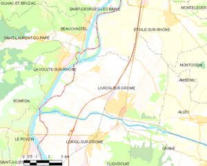
Livron-sur-Drôme
- commune in Drôme, France
 Hiking in Livron-sur-Drôme
Livron-sur-Drôme, located in the Auvergne-Rhône-Alpes region of southeastern France, offers a charming landscape for hiking enthusiasts. Nestled along the banks of the Drôme River, the area boasts a combination of natural beauty, cultural heritage, and varied terrains, making it an excellent destination for both casual walkers and more experienced hikers....
- Country:
- Postal Code: 26250
- Coordinates: 44° 46' 22" N, 4° 50' 35" E
- GPS tracks (wikiloc): [Link]
- Area: 39.52 sq km
- Population: 8910
- Web site: [Link]

Rompon
- commune in Ardèche, France
- Country:
- Postal Code: 07250
- Coordinates: 44° 45' 41" N, 4° 43' 24" E
- GPS tracks (wikiloc): [Link]
- Area: 22.03 sq km
- Population: 1053


Loriol-sur-Drôme
- commune in Drôme, France
Hiking in Loriol-sur-Drôme
Loriol-sur-Drôme is a charming village located in the Auvergne-Rhône-Alpes region of France, nestled along the banks of the Drôme River. This area offers a variety of hiking opportunities, characterized by its picturesque landscapes, varied terrain, and rich biodiversity. Here are some highlights for hiking in and around Loriol-sur-Drôme:...
- Country:
- Postal Code: 26270
- Coordinates: 44° 45' 6" N, 4° 49' 21" E
- GPS tracks (wikiloc): [Link]
- Area: 28.66 sq km
- Population: 6487
- Web site: [Link]