Le Rheu (Le Rheu)

- commune in Ille-et-Vilaine, France
- Country:

- Postal Code: 35650
- Coordinates: 48° 6' 7" N, 1° 47' 44" E


- GPS tracks (wikiloc): [Link]
- Area: 18.89 sq km
- Population: 8365
- Web site: http://www.lerheu.fr
- Wikipedia en: wiki(en)
- Wikipedia: wiki(fr)
- Wikidata storage: Wikidata: Q1160023
- Wikipedia Commons Category: [Link]
- Freebase ID: [/m/03m96ym]
- Freebase ID: [/m/03m96ym]
- GeoNames ID: Alt: [3002351]
- GeoNames ID: Alt: [3002351]
- SIREN number: [213502404]
- SIREN number: [213502404]
- BnF ID: [15257182c]
- BnF ID: [15257182c]
- VIAF ID: Alt: [246940254]
- VIAF ID: Alt: [246940254]
- OSM relation ID: [134311]
- OSM relation ID: [134311]
- MusicBrainz area ID: [61ac28f0-09be-4112-86ac-6c18f420dcc0]
- MusicBrainz area ID: [61ac28f0-09be-4112-86ac-6c18f420dcc0]
- INSEE municipality code: 35240
- INSEE municipality code: 35240
Shares border with regions:

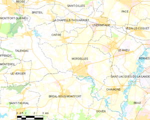
Mordelles
- commune in Ille-et-Vilaine, France
- Country:
- Postal Code: 35310
- Coordinates: 48° 4' 29" N, 1° 50' 45" E
- GPS tracks (wikiloc): [Link]
- Area: 29.76 sq km
- Population: 7275
- Web site: [Link]


Saint-Jacques-de-la-Lande
- commune in Ille-et-Vilaine, France
- Country:
- Postal Code: 35136
- Coordinates: 48° 5' 25" N, 1° 41' 44" E
- GPS tracks (wikiloc): [Link]
- Area: 11.83 sq km
- Population: 12587
- Web site: [Link]
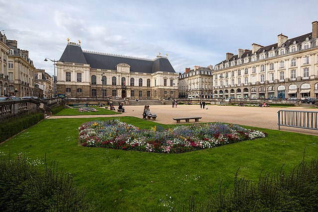

Rennes
- commune in Ille-et-Vilaine, France
- Country:
- Postal Code: 35700; 35200; 35000
- Coordinates: 48° 6' 51" N, 1° 40' 51" E
- GPS tracks (wikiloc): [Link]
- AboveSeaLevel: 74 м m
- Area: 50.39 sq km
- Population: 215366
- Web site: [Link]

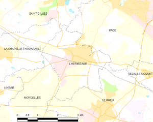
L'Hermitage
- commune in Ille-et-Vilaine, France
- Country:
- Postal Code: 35590
- Coordinates: 48° 7' 33" N, 1° 48' 57" E
- GPS tracks (wikiloc): [Link]
- Area: 6.83 sq km
- Population: 4227
- Web site: [Link]


Chavagne
- commune in Ille-et-Vilaine, France
- Country:
- Postal Code: 35310
- Coordinates: 48° 3' 15" N, 1° 47' 4" E
- GPS tracks (wikiloc): [Link]
- Area: 12.44 sq km
- Population: 3802
- Web site: [Link]


Vezin-le-Coquet
- commune in Ille-et-Vilaine, France
- Country:
- Postal Code: 35132
- Coordinates: 48° 7' 7" N, 1° 45' 22" E
- GPS tracks (wikiloc): [Link]
- Area: 7.86 sq km
- Population: 5401
- Web site: [Link]


Pacé
- commune in Ille-et-Vilaine, France
- Country:
- Postal Code: 35740
- Coordinates: 48° 8' 52" N, 1° 46' 26" E
- GPS tracks (wikiloc): [Link]
- Area: 34.94 sq km
- Population: 11531
- Web site: [Link]