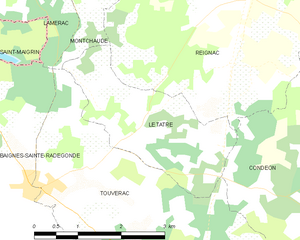
Le Tâtre (Le Tâtre)
- commune in Charente, France
- Country:

- Postal Code: 16360
- Coordinates: 45° 23' 44" N, 0° 12' 20" E


- GPS tracks (wikiloc): [Link]
- Area: 6.13 sq km
- Population: 391
- Wikipedia en: wiki(en)
- Wikipedia: wiki(fr)
- Wikidata storage: Wikidata: Q1410058
- Wikipedia Commons Category: [Link]
- Freebase ID: [/m/03mcd_6]
- GeoNames ID: Alt: [2999269]
- SIREN number: [211603808]
- BnF ID: [123063336]
- Library of Congress authority ID: Alt: [n94113414]
- INSEE municipality code: 16380
Shares border with regions:


Touvérac
- commune in Charente, France
- Country:

- Postal Code: 16360
- Coordinates: 45° 22' 52" N, 0° 12' 43" E


- GPS tracks (wikiloc): [Link]
- Area: 18.19 sq km
- Population: 685


Condéon
- commune in Charente, France
- Country:

- Postal Code: 16360
- Coordinates: 45° 24' 26" N, 0° 8' 12" E


- GPS tracks (wikiloc): [Link]
- Area: 31.4 sq km
- Population: 594


Montchaude
- former commune in Charente, France
- Country:

- Postal Code: 16300
- Coordinates: 45° 26' 51" N, 0° 12' 3" E


- GPS tracks (wikiloc): [Link]
- Area: 14.18 sq km
- Population: 529
- Web site: [Link]


Reignac
- commune in Charente, France
- Country:

- Postal Code: 16360
- Coordinates: 45° 25' 21" N, 0° 10' 59" E


- GPS tracks (wikiloc): [Link]
- Area: 22.14 sq km
- Population: 713
