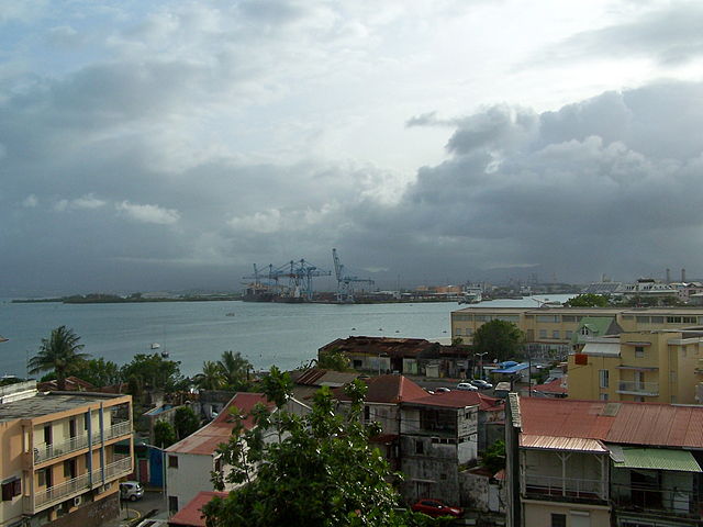
Les Abymes (Les Abymes)
- commune in Guadeloupe, France
- Country:

- Postal Code: 97142; 97139
- Coordinates: 16° 16' 14" N, 61° 30' 17" E


- GPS tracks (wikiloc): [Link]
- Area: 81.25 sq km
- Population: 55306
- Web site: http://www.ville-abymes.fr
- Wikipedia en: wiki(en)
- Wikipedia: wiki(fr)
- Wikidata storage: Wikidata: Q13636
- Wikipedia Commons Category: [Link]
- Freebase ID: [/m/0dhbw3]
- Freebase ID: [/m/0dhbw3]
- Freebase ID: [/m/0dhbw3]
- Freebase ID: [/m/0dhbw3]
- Freebase ID: [/m/0dhbw3]
- Freebase ID: [/m/0dhbw3]
- GeoNames ID: Alt: [3578959]
- GeoNames ID: Alt: [3578959]
- GeoNames ID: Alt: [3578959]
- GeoNames ID: Alt: [3578959]
- GeoNames ID: Alt: [3578959]
- GeoNames ID: Alt: [3578959]
- SIREN number: [219711017]
- SIREN number: [219711017]
- SIREN number: [219711017]
- SIREN number: [219711017]
- SIREN number: [219711017]
- SIREN number: [219711017]
- BnF ID: [12238125z]
- BnF ID: [12238125z]
- BnF ID: [12238125z]
- BnF ID: [12238125z]
- BnF ID: [12238125z]
- BnF ID: [12238125z]
- VIAF ID: Alt: [142844596]
- VIAF ID: Alt: [142844596]
- VIAF ID: Alt: [142844596]
- VIAF ID: Alt: [142844596]
- VIAF ID: Alt: [142844596]
- VIAF ID: Alt: [142844596]
- GND ID: Alt: [7625635-2]
- GND ID: Alt: [7625635-2]
- GND ID: Alt: [7625635-2]
- GND ID: Alt: [7625635-2]
- GND ID: Alt: [7625635-2]
- GND ID: Alt: [7625635-2]
- Library of Congress authority ID: Alt: [n85137152]
- Library of Congress authority ID: Alt: [n85137152]
- Library of Congress authority ID: Alt: [n85137152]
- Library of Congress authority ID: Alt: [n85137152]
- Library of Congress authority ID: Alt: [n85137152]
- Library of Congress authority ID: Alt: [n85137152]
- MusicBrainz area ID: [4ef535e6-f59f-40bf-8a71-292f21b6c8e0]
- MusicBrainz area ID: [4ef535e6-f59f-40bf-8a71-292f21b6c8e0]
- MusicBrainz area ID: [4ef535e6-f59f-40bf-8a71-292f21b6c8e0]
- MusicBrainz area ID: [4ef535e6-f59f-40bf-8a71-292f21b6c8e0]
- MusicBrainz area ID: [4ef535e6-f59f-40bf-8a71-292f21b6c8e0]
- MusicBrainz area ID: [4ef535e6-f59f-40bf-8a71-292f21b6c8e0]
- SUDOC authorities ID: [031099300]
- SUDOC authorities ID: [031099300]
- SUDOC authorities ID: [031099300]
- SUDOC authorities ID: [031099300]
- SUDOC authorities ID: [031099300]
- SUDOC authorities ID: [031099300]
- National Library of Israel ID: [001009251]
- National Library of Israel ID: [001009251]
- National Library of Israel ID: [001009251]
- National Library of Israel ID: [001009251]
- National Library of Israel ID: [001009251]
- National Library of Israel ID: [001009251]
- DNB editions: [990409511]
- DNB editions: [990409511]
- DNB editions: [990409511]
- DNB editions: [990409511]
- DNB editions: [990409511]
- DNB editions: [990409511]
- INSEE municipality code: 97101
- INSEE municipality code: 97101
- INSEE municipality code: 97101
- INSEE municipality code: 97101
- INSEE municipality code: 97101
- INSEE municipality code: 97101
Shares border with regions:

Pointe-à-Pitre
- commune in Guadeloupe, France
- Country:

- Postal Code: 97110
- Coordinates: 16° 14' 28" N, 61° 31' 59" E


- GPS tracks (wikiloc): [Link]
- AboveSeaLevel: 0 м m
- Area: 2.66 sq km
- Population: 16343
- Web site: [Link]
Sainte-Anne
- commune in Guadeloupe, France
- Country:

- Postal Code: 97180
- Coordinates: 16° 13' 32" N, 61° 23' 10" E


- GPS tracks (wikiloc): [Link]
- Area: 80.29 sq km
- Population: 24379
- Web site: [Link]

Baie-Mahault
- commune in Guadeloupe, France
- Country:

- Postal Code: 97122
- Coordinates: 16° 16' 3" N, 61° 35' 13" E


- GPS tracks (wikiloc): [Link]
- Area: 46 sq km
- Population: 31209
- Web site: [Link]

Le Moule
- commune in Guadeloupe, France
- Country:

- Postal Code: 97160
- Coordinates: 16° 19' 52" N, 61° 20' 37" E


- GPS tracks (wikiloc): [Link]
- AboveSeaLevel: 4 м m
- Area: 82.84 sq km
- Population: 22329
- Web site: [Link]
Le Gosier
- commune in Guadeloupe, France
- Country:

- Postal Code: 97190
- Coordinates: 16° 12' 20" N, 61° 29' 31" E


- GPS tracks (wikiloc): [Link]
- Area: 45.2 sq km
- Population: 27057
- Web site: [Link]

Morne-à-l'Eau
- commune in Guadeloupe, France
- Country:

- Postal Code: 97111
- Coordinates: 16° 19' 55" N, 61° 27' 25" E


- GPS tracks (wikiloc): [Link]
- Area: 64.5 sq km
- Population: 17407
- Web site: [Link]