Les Cerqueux (Les Cerqueux)

- commune in Maine-et-Loire, France
- Country:

- Postal Code: 49360
- Coordinates: 47° 0' 1" N, 0° 38' 26" E


- GPS tracks (wikiloc): [Link]
- AboveSeaLevel: 150 м m
- Area: 13.86 sq km
- Population: 887
- Web site: http://lescerqueux.monclocher.com/
- Wikipedia en: wiki(en)
- Wikipedia: wiki(fr)
- Wikidata storage: Wikidata: Q1155543
- Wikipedia Commons Category: [Link]
- Freebase ID: [/m/03x_spx]
- GeoNames ID: Alt: [3001586]
- SIREN number: [214900581]
- INSEE municipality code: 49058
Shares border with regions:
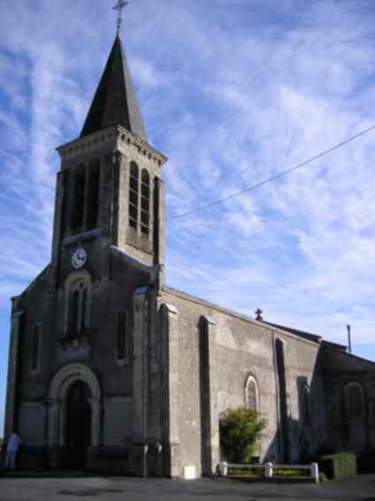

Étusson
- former commune in Deux-Sèvres, France
- Country:
- Postal Code: 79150
- Coordinates: 47° 0' 52" N, 0° 30' 51" E
- GPS tracks (wikiloc): [Link]
- Area: 20.97 sq km
- Population: 333


Yzernay
- commune in Maine-et-Loire, France
- Country:
- Postal Code: 49360
- Coordinates: 47° 1' 18" N, 0° 42' 10" E
- GPS tracks (wikiloc): [Link]
- Area: 40.66 sq km
- Population: 1850


Somloire
- commune in Maine-et-Loire, France
- Country:
- Postal Code: 49360
- Coordinates: 47° 2' 1" N, 0° 36' 23" E
- GPS tracks (wikiloc): [Link]
- Area: 31.83 sq km
- Population: 905

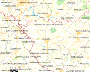
Mauléon
- commune in Deux-Sèvres, France
- Country:
- Postal Code: 79700
- Coordinates: 46° 55' 22" N, 0° 44' 59" E
- GPS tracks (wikiloc): [Link]
- Area: 120.64 sq km
- Population: 8479

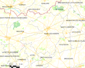
Nueil-les-Aubiers
- commune in Deux-Sèvres, France
- Country:
- Postal Code: 79250
- Coordinates: 46° 56' 14" N, 0° 35' 24" E
- GPS tracks (wikiloc): [Link]
- AboveSeaLevel: 126 м m
- Area: 98.83 sq km
- Population: 5614
- Web site: [Link]