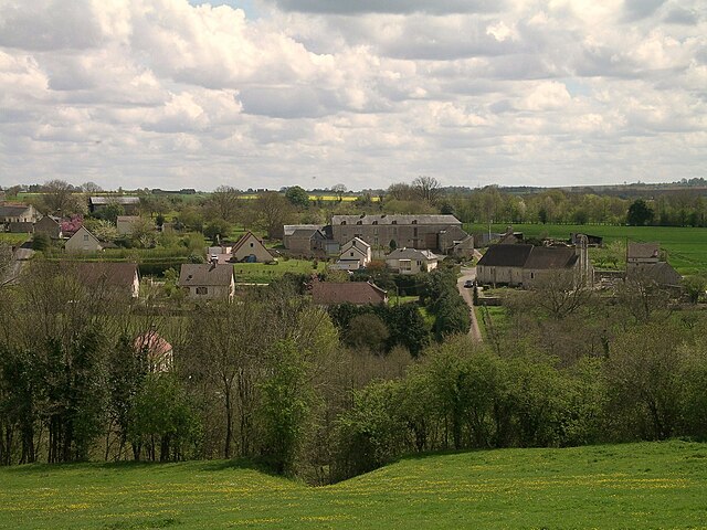
Les Moutiers-en-Cinglais (Les Moutiers-en-Cinglais)

- commune in Calvados, France
- Country:

- Postal Code: 14220
- Coordinates: 49° 1' 52" N, 0° 25' 22" E


- GPS tracks (wikiloc): [Link]
- AboveSeaLevel: 114 м m
- Area: 6.75 sq km
- Population: 486
- Wikipedia en: wiki(en)
- Wikipedia: wiki(fr)
- Wikidata storage: Wikidata: Q549997
- Wikipedia Commons Category: [Link]
- Freebase ID: [/m/030gg_]
- Freebase ID: [/m/030gg_]
- GeoNames ID: Alt: [6455585]
- GeoNames ID: Alt: [6455585]
- SIREN number: [211404587]
- SIREN number: [211404587]
- BnF ID: [152478703]
- BnF ID: [152478703]
- INSEE municipality code: 14458
- INSEE municipality code: 14458
Shares border with regions:

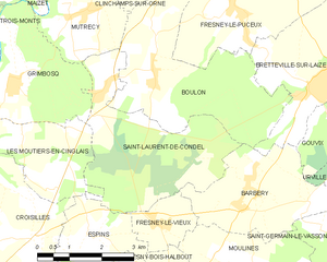
Saint-Laurent-de-Condel
- commune in Calvados, France
- Country:
- Postal Code: 14220
- Coordinates: 49° 2' 28" N, 0° 24' 54" E
- GPS tracks (wikiloc): [Link]
- Area: 12.31 sq km
- Population: 483


Grimbosq
- commune in Calvados, France
- Country:
- Postal Code: 14220
- Coordinates: 49° 2' 37" N, 0° 27' 7" E
- GPS tracks (wikiloc): [Link]
- Area: 8.63 sq km
- Population: 294


Goupillières
- commune in Calvados, France
- Country:
- Postal Code: 14210
- Coordinates: 49° 1' 55" N, 0° 28' 46" E
- GPS tracks (wikiloc): [Link]
- Area: 2.27 sq km
- Population: 178

Espins
- commune in Calvados, France
- Country:
- Postal Code: 14220
- Coordinates: 49° 0' 3" N, 0° 24' 45" E
- GPS tracks (wikiloc): [Link]
- Area: 4.58 sq km
- Population: 229


Ouffières
- commune in Calvados, France
- Country:
- Postal Code: 14220
- Coordinates: 49° 1' 25" N, 0° 29' 28" E
- GPS tracks (wikiloc): [Link]
- Area: 4.21 sq km
- Population: 190
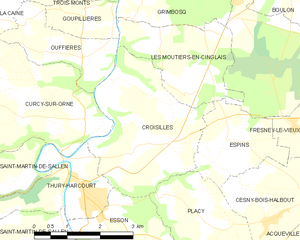
Croisilles
- commune in Calvados, France
- Country:
- Postal Code: 14220
- Coordinates: 48° 59' 53" N, 0° 27' 18" E
- GPS tracks (wikiloc): [Link]
- Area: 10.23 sq km
- Population: 643