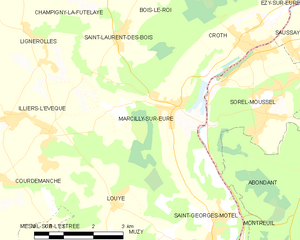
Lignerolles (Lignerolles)

- commune in Eure, France
- Country:

- Postal Code: 27220
- Coordinates: 48° 50' 49" N, 1° 16' 32" E


- GPS tracks (wikiloc): [Link]
- Area: 6.22 sq km
- Population: 314
- Wikipedia en: wiki(en)
- Wikipedia: wiki(fr)
- Wikidata storage: Wikidata: Q1074033
- Wikipedia Commons Category: [Link]
- Freebase ID: [/m/03mhrhr]
- Freebase ID: [/m/03mhrhr]
- GeoNames ID: Alt: [6430461]
- GeoNames ID: Alt: [6430461]
- SIREN number: [212703680]
- SIREN number: [212703680]
- BnF ID: [15253603n]
- BnF ID: [15253603n]
- VIAF ID: Alt: [247901671]
- VIAF ID: Alt: [247901671]
- INSEE municipality code: 27368
- INSEE municipality code: 27368
Shares border with regions:


Illiers-l'Évêque
- commune in Eure, France
- Country:
- Postal Code: 27770
- Coordinates: 48° 49' 15" N, 1° 16' 0" E
- GPS tracks (wikiloc): [Link]
- Area: 20.63 sq km
- Population: 993

Marcilly-sur-Eure
- commune in Eure, France
- Country:
- Postal Code: 27810
- Coordinates: 48° 49' 35" N, 1° 20' 48" E
- GPS tracks (wikiloc): [Link]
- Area: 15.48 sq km
- Population: 1566


Coudres
- commune in Eure, France
- Country:
- Postal Code: 27220
- Coordinates: 48° 51' 44" N, 1° 14' 39" E
- GPS tracks (wikiloc): [Link]
- Area: 15.37 sq km
- Population: 546


Champigny-la-Futelaye
- commune in Eure, France
- Country:
- Postal Code: 27220
- Coordinates: 48° 51' 50" N, 1° 17' 52" E
- GPS tracks (wikiloc): [Link]
- Area: 15.98 sq km
- Population: 279