Longevilles-Mont-d'Or (Longevilles-Mont-d'Or)

- commune in Doubs, France
 Hiking in Longevilles-Mont-d'Or
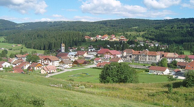
Longevilles-Mont-d'Or is a charming commune located in the Jura department of France, renowned for its picturesque landscapes and hiking opportunities. Nestled in the mountains, it is an ideal location for outdoor enthusiasts looking to explore nature.
Hiking Highlights:
-
Scenic Trails: The area boasts a variety of well-marked hiking trails that cater to different skill levels. You can enjoy serene walks through forests, meadows, and along ridgelines that offer stunning views of the surrounding Jura mountains.
-
Natural Beauty: The region is characterized by its lush greenery, diverse fauna and flora, and panoramic views. As you hike, you might encounter local wildlife and seasonal wildflowers, making each hike a unique experience.
-
Cultural Heritage: Some trails lead to historical sites or villages that reflect the rich cultural heritage of the region. Take the time to explore local architecture and perhaps visit a traditional cheese farm to taste the local specialties.
-
Breathtaking Views: Look for viewpoints along the trails that offer breathtaking vistas of the Jura mountains and the valley below. Sunrise and sunset hikes can be particularly rewarding.
-
Seasonal Hiking: Depending on the season, hiking conditions may vary. Spring and summer are great for wildflower viewing, while autumn offers vibrant foliage. Winter hiking may also be available if you’re interested in snowshoeing or winter landscapes.
Preparations:
- Trail Maps: Ensure you have a detailed map or a GPS app for the trails you plan to explore.
- Gear: Pack appropriate gear, including sturdy hiking boots, weather-appropriate clothing, and plenty of water and snacks.
- Local Regulations: Familiarize yourself with any local regulations or recommendations, particularly concerning wildlife and conservation efforts.
Recommendations:
- Guided Tours: If you're new to the area, consider joining a guided hike to learn more about the local ecology and history from experienced guides.
- Safety First: Always inform someone of your hiking plans and expected return time, particularly if you are hiking alone or in remote areas.
In summary, Longevilles-Mont-d'Or offers a delightful hiking experience with its beautiful landscapes, well-maintained trails, and opportunities to connect with nature and local culture. Enjoy your adventure!
- Country:

- Postal Code: 25370
- Coordinates: 46° 45' 14" N, 6° 19' 0" E


- GPS tracks (wikiloc): [Link]
- Area: 13.25 sq km
- Population: 530
- Wikipedia en: wiki(en)
- Wikipedia: wiki(fr)
- Wikidata storage: Wikidata: Q909934
- Wikipedia Commons Category: [Link]
- Freebase ID: [/m/03mgbvt]
- Freebase ID: [/m/03mgbvt]
- GeoNames ID: Alt: [2997715]
- GeoNames ID: Alt: [2997715]
- SIREN number: [212503486]
- SIREN number: [212503486]
- BnF ID: [15252574n]
- BnF ID: [15252574n]
- PACTOLS thesaurus ID: [pcrtDyQXbGeHqS]
- PACTOLS thesaurus ID: [pcrtDyQXbGeHqS]
- WOEID: [608538]
- WOEID: [608538]
- INSEE municipality code: 25348
- INSEE municipality code: 25348
Shares border with regions:

Rochejean
- commune in Doubs, France
Hiking in Rochejean
Rochejean, located in the Jura mountains of France, is a beautiful destination for hiking enthusiasts. Known for its stunning landscapes, lush forests, and diverse wildlife, Rochejean offers a range of trails suitable for various skill levels....
- Country:
- Postal Code: 25370
- Coordinates: 46° 44' 44" N, 6° 17' 37" E
- GPS tracks (wikiloc): [Link]
- Area: 24.32 sq km
- Population: 680


Saint-Antoine
- commune in Doubs, France
Hiking in Saint-Antoine
Saint-Antoine, located in the Doubs department of the Bourgogne-Franche-Comté region in eastern France, is an excellent destination for hiking enthusiasts. This area is characterized by stunning natural landscapes, including forests, rolling hills, and picturesque views of the surrounding countryside....
- Country:
- Postal Code: 25370
- Coordinates: 46° 46' 37" N, 6° 20' 16" E
- GPS tracks (wikiloc): [Link]
- Area: 4.51 sq km
- Population: 336