Lonlay-l'Abbaye (Lonlay-l'Abbaye)

- commune in Orne, France
- Country:

- Postal Code: 61700
- Coordinates: 48° 38' 48" N, 0° 42' 36" E


- GPS tracks (wikiloc): [Link]
- Area: 53.41 sq km
- Population: 1142
- Web site: http://www.lonlaylabbaye.com/
- Wikipedia en: wiki(en)
- Wikipedia: wiki(fr)
- Wikidata storage: Wikidata: Q1347375
- Wikipedia Commons Category: [Link]
- Freebase ID: [/m/03x_x74]
- Freebase ID: [/m/03x_x74]
- GeoNames ID: Alt: [6612695]
- GeoNames ID: Alt: [6612695]
- SIREN number: [216102327]
- SIREN number: [216102327]
- BnF ID: [15268164w]
- BnF ID: [15268164w]
- VIAF ID: Alt: [312668971]
- VIAF ID: Alt: [312668971]
- WOEID: [608601]
- WOEID: [608601]
- INSEE municipality code: 61232
- INSEE municipality code: 61232
Shares border with regions:

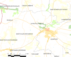
La Haute-Chapelle
- former commune in Orne, France
- Country:
- Postal Code: 61700
- Coordinates: 48° 36' 18" N, 0° 40' 17" E
- GPS tracks (wikiloc): [Link]
- Area: 19.31 sq km
- Population: 597


Saint-Bômer-les-Forges
- commune in Orne, France
- Country:
- Postal Code: 61700
- Coordinates: 48° 38' 38" N, 0° 38' 0" E
- GPS tracks (wikiloc): [Link]
- Area: 31.08 sq km
- Population: 1043
- Web site: [Link]


Ger
- commune in Manche, France
- Country:
- Postal Code: 50850
- Coordinates: 48° 40' 54" N, 0° 47' 19" E
- GPS tracks (wikiloc): [Link]
- Area: 39.78 sq km
- Population: 821

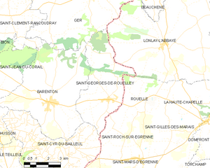
Saint-Georges-de-Rouelley
- commune in Manche, France
- Country:
- Postal Code: 50720
- Coordinates: 48° 36' 13" N, 0° 46' 6" E
- GPS tracks (wikiloc): [Link]
- Area: 20.52 sq km
- Population: 562
- Web site: [Link]

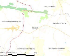
Rouellé
- former commune in Orne, France
- Country:
- Postal Code: 61700
- Coordinates: 48° 36' 4" N, 0° 43' 34" E
- GPS tracks (wikiloc): [Link]
- Area: 10.64 sq km
- Population: 200