Loos-en-Gohelle (Loos-en-Gohelle)

- commune in Pas-de-Calais, France
- Country:

- Postal Code: 62750
- Coordinates: 50° 27' 28" N, 2° 47' 36" E


- GPS tracks (wikiloc): [Link]
- Area: 12.7 sq km
- Population: 6568
- Web site: http://www.loos-en-gohelle.fr
- Wikipedia en: wiki(en)
- Wikipedia: wiki(fr)
- Wikidata storage: Wikidata: Q323727
- Wikipedia Commons Category: [Link]
- Freebase ID: [/m/025qxf]
- GeoNames ID: Alt: [2997619]
- SIREN number: [216205286]
- BnF ID: [15268969t]
- VIAF ID: Alt: [147940631]
- Library of Congress authority ID: Alt: [n2002021809]
- INSEE municipality code: 62528
Shares border with regions:


Lens
- commune in Pas-de-Calais, France
- Country:
- Postal Code: 62300
- Coordinates: 50° 25' 53" N, 2° 49' 57" E
- GPS tracks (wikiloc): [Link]
- Area: 11.7 sq km
- Population: 30413
- Web site: [Link]


Liévin
- commune in Pas-de-Calais, France
- Country:
- Postal Code: 62800
- Coordinates: 50° 25' 19" N, 2° 46' 40" E
- GPS tracks (wikiloc): [Link]
- Area: 12.83 sq km
- Population: 31237
- Web site: [Link]


Mazingarbe
- commune in Pas-de-Calais, France
- Country:
- Postal Code: 62670
- Coordinates: 50° 28' 23" N, 2° 43' 5" E
- GPS tracks (wikiloc): [Link]
- Area: 10.29 sq km
- Population: 7970
- Web site: [Link]


Hulluch
- commune in Pas-de-Calais, France
- Country:
- Postal Code: 62410
- Coordinates: 50° 29' 9" N, 2° 49' 0" E
- GPS tracks (wikiloc): [Link]
- Area: 5.74 sq km
- Population: 3424


Bénifontaine
- commune in Pas-de-Calais, France
- Country:
- Postal Code: 62410
- Coordinates: 50° 29' 13" N, 2° 49' 49" E
- GPS tracks (wikiloc): [Link]
- Area: 4.24 sq km
- Population: 359
- Web site: [Link]


Vendin-le-Vieil
- commune in Pas-de-Calais, France
- Country:
- Postal Code: 62880
- Coordinates: 50° 28' 26" N, 2° 51' 58" E
- GPS tracks (wikiloc): [Link]
- Area: 10.67 sq km
- Population: 8227
- Web site: [Link]


Haisnes
- commune in Pas-de-Calais, France
- Country:
- Postal Code: 62138
- Coordinates: 50° 30' 29" N, 2° 48' 6" E
- GPS tracks (wikiloc): [Link]
- Area: 5.58 sq km
- Population: 4367
- Web site: [Link]


Vermelles
- commune in Pas-de-Calais, France
- Country:
- Postal Code: 62980
- Coordinates: 50° 29' 18" N, 2° 44' 45" E
- GPS tracks (wikiloc): [Link]
- Area: 10.39 sq km
- Population: 4653
- Web site: [Link]

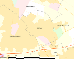
Grenay
- commune in Pas-de-Calais, France
- Country:
- Postal Code: 62160
- Coordinates: 50° 27' 8" N, 2° 44' 35" E
- GPS tracks (wikiloc): [Link]
- Area: 3.22 sq km
- Population: 6914
- Web site: [Link]