Loudes (Loudes)

- commune in Haute-Loire, France
- Country:

- Postal Code: 43320
- Coordinates: 45° 5' 17" N, 3° 44' 55" E


- GPS tracks (wikiloc): [Link]
- Area: 24.33 sq km
- Population: 902
- Wikipedia en: wiki(en)
- Wikipedia: wiki(fr)
- Wikidata storage: Wikidata: Q264778
- Wikipedia Commons Category: [Link]
- Freebase ID: [/m/03ntn10]
- GeoNames ID: Alt: [2997461]
- SIREN number: [214301244]
- BnF ID: [152600295]
- VIAF ID: Alt: [239124709]
- INSEE municipality code: 43124
Shares border with regions:
Borne
- commune in Haute-Loire, France
- Country:
- Postal Code: 43350
- Coordinates: 45° 6' 0" N, 3° 47' 56" E
- GPS tracks (wikiloc): [Link]
- Area: 5.48 sq km
- Population: 424


Saint-Vidal
- commune in Haute-Loire, France
- Country:
- Postal Code: 43320
- Coordinates: 45° 4' 29" N, 3° 48' 0" E
- GPS tracks (wikiloc): [Link]
- Area: 7.71 sq km
- Population: 584


Vazeilles-Limandre
- commune in Haute-Loire, France
- Country:
- Postal Code: 43320
- Coordinates: 45° 6' 50" N, 3° 41' 54" E
- GPS tracks (wikiloc): [Link]
- Area: 11.72 sq km
- Population: 252


Saint-Paulien
- commune in Haute-Loire, France
- Country:
- Postal Code: 43350
- Coordinates: 45° 8' 11" N, 3° 48' 46" E
- GPS tracks (wikiloc): [Link]
- Area: 40.63 sq km
- Population: 2402
- Web site: [Link]
Lissac
- commune in Haute-Loire, France
- Country:
- Postal Code: 43350
- Coordinates: 45° 7' 58" N, 3° 46' 2" E
- GPS tracks (wikiloc): [Link]
- Area: 12.03 sq km
- Population: 267


Chaspuzac
- commune in Haute-Loire, France
- Country:
- Postal Code: 43320
- Coordinates: 45° 4' 5" N, 3° 44' 57" E
- GPS tracks (wikiloc): [Link]
- Area: 9.77 sq km
- Population: 767

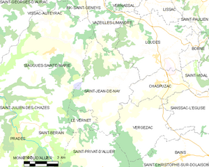
Saint-Jean-de-Nay
- commune in Haute-Loire, France
- Country:
- Postal Code: 43320
- Coordinates: 45° 4' 8" N, 3° 41' 47" E
- GPS tracks (wikiloc): [Link]
- Area: 28.26 sq km
- Population: 361