Louverné (Louverné)

- commune in Mayenne, France
- Country:

- Postal Code: 53950
- Coordinates: 48° 7' 22" N, 0° 43' 5" E


- GPS tracks (wikiloc): [Link]
- Area: 20.58 sq km
- Population: 4163
- Web site: http://www.louverne.fr/
- Wikipedia en: wiki(en)
- Wikipedia: wiki(fr)
- Wikidata storage: Wikidata: Q1101800
- Wikipedia Commons Category: [Link]
- Freebase ID: [/m/03np_cs]
- GeoNames ID: Alt: [6436424]
- SIREN number: [215301409]
- BnF ID: [15263933m]
- MusicBrainz area ID: [6ca4851d-faab-42e4-8e87-12f3320b4594]
- Twitter username: Alt: [VilleLouverne]
- INSEE municipality code: 53140
Shares border with regions:


Changé
- commune in Mayenne, France
- Country:
- Postal Code: 53810
- Coordinates: 48° 6' 0" N, 0° 47' 27" E
- GPS tracks (wikiloc): [Link]
- Area: 34.68 sq km
- Population: 5764
- Web site: [Link]


Sacé
- commune in Mayenne, France
- Country:
- Postal Code: 53470
- Coordinates: 48° 11' 8" N, 0° 42' 48" E
- GPS tracks (wikiloc): [Link]
- AboveSeaLevel: 210 м m
- Area: 12.46 sq km
- Population: 496
- Web site: [Link]


Saint-Jean-sur-Mayenne
- commune in Mayenne, France
- Country:
- Postal Code: 53240
- Coordinates: 48° 7' 59" N, 0° 45' 8" E
- GPS tracks (wikiloc): [Link]
- Area: 17.81 sq km
- Population: 1654
- Web site: [Link]

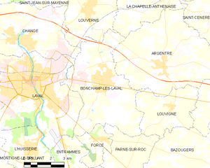
Bonchamp-lès-Laval
- commune in Mayenne, France
- Country:
- Postal Code: 53960
- Coordinates: 48° 4' 27" N, 0° 42' 5" E
- GPS tracks (wikiloc): [Link]
- Area: 27.51 sq km
- Population: 5900
- Web site: [Link]

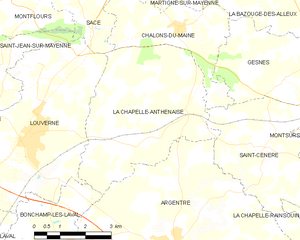
La Chapelle-Anthenaise
- commune in Mayenne, France
- Country:
- Postal Code: 53950
- Coordinates: 48° 7' 21" N, 0° 40' 38" E
- GPS tracks (wikiloc): [Link]
- Area: 19.89 sq km
- Population: 975
- Web site: [Link]