Luri (Luri)

- commune in Haute-Corse, France
- Country:

- Postal Code: 20228
- Coordinates: 42° 53' 48" N, 9° 24' 19" E


- GPS tracks (wikiloc): [Link]
- AboveSeaLevel: 600 м m
- Area: 27.53 sq km
- Population: 835
- Web site: http://www.destination-cap-corse.com/communaute-communes/cap-corse.php?menu=96&ssm=103&rech=luri
- Wikipedia en: wiki(en)
- Wikipedia: wiki(fr)
- Wikidata storage: Wikidata: Q944665
- Wikipedia Commons Category: [Link]
- Freebase ID: [/m/0c7fs8]
- Freebase ID: [/m/0c7fs8]
- GeoNames ID: Alt: [6616400]
- GeoNames ID: Alt: [6616400]
- SIREN number: [212001523]
- SIREN number: [212001523]
- BnF ID: [152501413]
- BnF ID: [152501413]
- Digital Atlas of the Roman Empire ID: [41690]
- Digital Atlas of the Roman Empire ID: [41690]
- INSEE municipality code: 2B152
- INSEE municipality code: 2B152
Shares border with regions:


Cagnano
- commune in Haute-Corse, France
- Country:
- Postal Code: 20228
- Coordinates: 42° 52' 31" N, 9° 25' 47" E
- GPS tracks (wikiloc): [Link]
- AboveSeaLevel: 300 м m
- Area: 14.72 sq km
- Population: 172


Morsiglia
- commune in Haute-Corse, France
- Country:
- Postal Code: 20238
- Coordinates: 42° 56' 44" N, 9° 21' 52" E
- GPS tracks (wikiloc): [Link]
- AboveSeaLevel: 200 м m
- Area: 13.34 sq km
- Population: 136
- Web site: [Link]

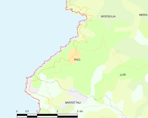
Pino
- commune in Haute-Corse, France
- Country:
- Postal Code: 20228
- Coordinates: 42° 54' 29" N, 9° 21' 5" E
- GPS tracks (wikiloc): [Link]
- AboveSeaLevel: 250 м m
- Area: 7.04 sq km
- Population: 151


Pietracorbara
- commune in Haute-Corse, France
- Country:
- Postal Code: 20233
- Coordinates: 42° 50' 47" N, 9° 25' 47" E
- GPS tracks (wikiloc): [Link]
- AboveSeaLevel: 350 м m
- Area: 26.15 sq km
- Population: 647
- Web site: [Link]


Barrettali
- commune in Haute-Corse, France
- Country:
- Postal Code: 20228
- Coordinates: 42° 52' 37" N, 9° 21' 19" E
- GPS tracks (wikiloc): [Link]
- AboveSeaLevel: 300 м m
- Area: 18.07 sq km
- Population: 131
- Web site: [Link]


Meria
- commune in Haute-Corse, France
- Country:
- Postal Code: 20287
- Coordinates: 42° 55' 37" N, 9° 27' 10" E
- GPS tracks (wikiloc): [Link]
- AboveSeaLevel: 200 м m
- Area: 20.43 sq km
- Population: 107