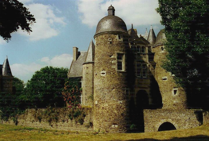
Ménil (Ménil)

- commune in Mayenne, France
- Country:

- Postal Code: 53200
- Coordinates: 47° 46' 31" N, 0° 40' 35" E


- GPS tracks (wikiloc): [Link]
- Area: 28.7 sq km
- Population: 987
- Web site: http://menil53.fr
- Wikipedia en: wiki(en)
- Wikipedia: wiki(fr)
- Wikidata storage: Wikidata: Q641188
- Wikipedia Commons Category: [Link]
- Freebase ID: [/m/03nq0g4]
- Freebase ID: [/m/03nq0g4]
- GeoNames ID: Alt: [6454288]
- GeoNames ID: Alt: [6454288]
- SIREN number: [215301508]
- SIREN number: [215301508]
- BnF ID: [15263943x]
- BnF ID: [15263943x]
- Library of Congress authority ID: Alt: [no2013020681]
- Library of Congress authority ID: Alt: [no2013020681]
- INSEE municipality code: 53150
- INSEE municipality code: 53150
Shares border with regions:


Azé
- commune in Mayenne, France
- Country:
- Postal Code: 53200
- Coordinates: 47° 49' 17" N, 0° 41' 6" E
- GPS tracks (wikiloc): [Link]
- Area: 29.67 sq km
- Population: 3375
- Web site: [Link]


La Jaille-Yvon
- commune in Maine-et-Loire, France
- Country:
- Postal Code: 49220
- Coordinates: 47° 43' 21" N, 0° 40' 14" E
- GPS tracks (wikiloc): [Link]
- Area: 12.55 sq km
- Population: 319


Marigné
- former commune in Maine-et-Loire, France
- Country:
- Postal Code: 49330
- Coordinates: 47° 43' 21" N, 0° 37' 8" E
- GPS tracks (wikiloc): [Link]
- Area: 24.41 sq km
- Population: 686
- Web site: [Link]


Montguillon
- former commune in Maine-et-Loire, France
- Country:
- Postal Code: 49500
- Coordinates: 47° 43' 41" N, 0° 44' 41" E
- GPS tracks (wikiloc): [Link]
- Area: 11.91 sq km
- Population: 239
- Web site: [Link]


Coudray
- commune in Mayenne, France
- Country:
- Postal Code: 53200
- Coordinates: 47° 47' 28" N, 0° 38' 39" E
- GPS tracks (wikiloc): [Link]
- Area: 11.01 sq km
- Population: 879


Saint-Fort
- commune in Mayenne, France
- Country:
- Postal Code: 53200
- Coordinates: 47° 47' 51" N, 0° 43' 17" E
- GPS tracks (wikiloc): [Link]
- Area: 10.79 sq km
- Population: 1637
- Web site: [Link]


Chemazé
- commune in Mayenne, France
- Country:
- Postal Code: 53200
- Coordinates: 47° 47' 14" N, 0° 46' 29" E
- GPS tracks (wikiloc): [Link]
- Area: 38.54 sq km
- Population: 1366
- Web site: [Link]

Daon
- commune in Mayenne, France
- Country:
- Postal Code: 53200
- Coordinates: 47° 45' 0" N, 0° 38' 20" E
- GPS tracks (wikiloc): [Link]
- Area: 17.93 sq km
- Population: 479