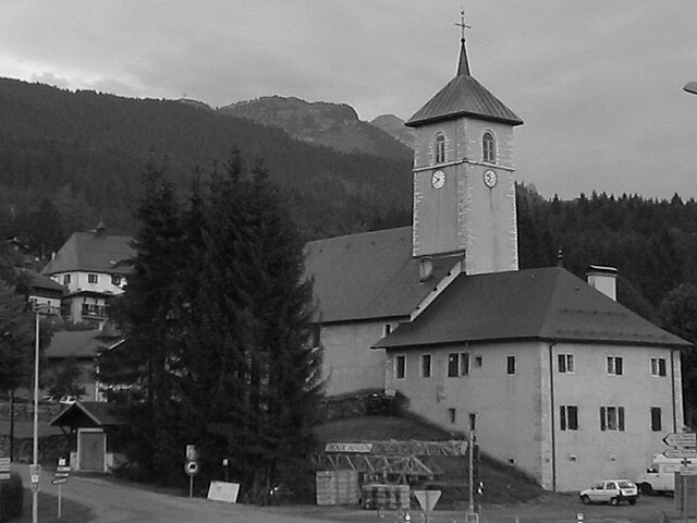
Magland (Magland)

- commune in Haute-Savoie, France
 Hiking in Magland
Magland, located in the Haute-Savoie region of France, is a beautiful destination for hiking enthusiasts. Nestled in the heart of the French Alps, this charming village offers stunning views, diverse terrains, and a range of hiking trails suitable for all skill levels. Here’s what you need to know about hiking in Magland:
Trails and Routes
-
Local Trails: Magland has several marked trails that allow you to explore the beautiful natural surroundings. Many of these trails lead through forests, alpine meadows, and along rivers, offering breathtaking scenery.
-
Access to Larger Hiking Areas: Magland serves as a gateway to the larger Mont Blanc range. From here, hikers can access more challenging routes that lead to peaks and passes with spectacular panoramic views.
-
Connectivity: The region is interconnected with other hiking routes in the surrounding areas, making it possible to plan longer treks or multi-day hikes.
Skill Levels
- Beginner: There are gentle paths and easier trails ideal for families or novice hikers looking to enjoy the alpine landscape without strenuous effort.
- Intermediate: Moderate trails offer a bit more challenge and often include some elevation gain, providing a good workout while still being achievable.
- Advanced: For experienced hikers, there are more rugged trails that may involve steep ascents, rocky paths, and possibly the need for climbing gear.
Best Times to Hike
- Summer (June to September): This is the prime hiking season. The weather is generally warm, and the trails are clear of snow. Flowers are in bloom, making the landscapes vibrant and colorful.
- Autumn (October): Early autumn can also be a great time for hiking, with fewer crowds and stunning fall colors, though temperatures can start to drop and some trails may be less accessible due to early snowfall.
Safety and Preparation
- Gear: Always invest in good hiking footwear, dress in layers, and carry essentials like water, snacks, a first-aid kit, and a map. Trekking poles can also be helpful on uneven terrain.
- Weather: The weather can change rapidly in the mountains, so check forecasts before heading out and be prepared for sudden shifts.
- Local Guidance: Consider local guided tours if you’re unfamiliar with the area or seek to explore more challenging routes safely.
Additional Activities
Aside from hiking, Magland offers opportunities for mountain biking, climbing, and photography, making it a well-rounded destination for outdoor enthusiasts.
In summary, hiking in Magland provides a wonderful opportunity to experience the natural beauty of the French Alps, catering to a variety of skill levels and interests. Whether you're looking for a leisurely stroll or a challenging trek, you’ll find plenty to enjoy in this scenic region.
- Country:

- Postal Code: 74300
- Coordinates: 46° 1' 19" N, 6° 37' 11" E


- GPS tracks (wikiloc): [Link]
- Area: 40.32 sq km
- Population: 3301
- Web site: http://www.magland.fr
- Wikipedia en: wiki(en)
- Wikipedia: wiki(fr)
- Wikidata storage: Wikidata: Q506831
- Wikipedia Commons Category: [Link]
- Freebase ID: [/m/03ntx9m]
- GeoNames ID: Alt: [6442977]
- SIREN number: [217401595]
- BnF ID: [15274417f]
- VIAF ID: Alt: [246567249]
- WOEID: [609205]
- INSEE municipality code: 74159
Shares border with regions:


Passy
- commune in Haute-Savoie, France
Hiking in Passy
Passy, located in the Haute-Savoie region of France, is a beautiful destination for hiking enthusiasts with its stunning alpine scenery and diverse trails. Here are some highlights and tips for hiking in and around Passy:...
- Country:
- Postal Code: 74480
- Coordinates: 45° 55' 25" N, 6° 41' 11" E
- GPS tracks (wikiloc): [Link]
- Area: 80.03 sq km
- Population: 11011
- Web site: [Link]


Nancy-sur-Cluses
- commune in Haute-Savoie, France
Hiking in Nancy-sur-Cluses
Nancy-sur-Cluses is a picturesque village located in the Haute-Savoie region of the French Alps, offering a variety of hiking opportunities for outdoor enthusiasts. The area's stunning mountainous landscapes, lush green valleys, and charming alpine atmosphere make it an appealing destination for hikers of all levels. Here are some highlights about hiking in Nancy-sur-Cluses:...
- Country:
- Postal Code: 74300
- Coordinates: 46° 2' 36" N, 6° 34' 39" E
- GPS tracks (wikiloc): [Link]
- Area: 14.22 sq km
- Population: 429
- Web site: [Link]

Arâches-la-Frasse
- commune in Haute-Savoie, France
Hiking in Arâches-la-Frasse
Arâches-la-Frasse is a charming commune located in the Haute-Savoie region of the French Alps. It is known for its stunning landscapes and proximity to the Grand Massif ski area, which also offers numerous hiking opportunities during the warmer months....
- Country:
- Postal Code: 74300
- Coordinates: 46° 2' 36" N, 6° 37' 53" E
- GPS tracks (wikiloc): [Link]
- Area: 37.69 sq km
- Population: 1928


Cluses
- commune in Haute-Savoie, France
Hiking in Cluses
Cluses, located in the Haute-Savoie region of France, is a beautiful destination for hiking enthusiasts. Nestled in the heart of the Alps, it offers a variety of trails that cater to different skill levels and preferences. Here’s what you can expect when hiking in and around Cluses:...
- Country:
- Postal Code: 74300
- Coordinates: 46° 3' 37" N, 6° 34' 43" E
- GPS tracks (wikiloc): [Link]
- Area: 10.46 sq km
- Population: 17538
- Web site: [Link]


Le Reposoir
- commune in Haute-Savoie, France
Hiking in Le Reposoir
Le Reposoir is a beautiful area located in the French Alps, specifically in the Haute-Savoie region, well-known for its scenic views, lush landscapes, and quaint alpine villages. While it may not be as popular as some other hiking destinations in the Alps, it offers a variety of hiking opportunities for both beginners and experienced hikers....
- Country:
- Postal Code: 74950
- Coordinates: 46° 0' 41" N, 6° 32' 7" E
- GPS tracks (wikiloc): [Link]
- Area: 37.36 sq km
- Population: 509
- Web site: [Link]


Sallanches
- commune in Haute-Savoie, France
Hiking in Sallanches
Sallanches, located in the Haute-Savoie region of the French Alps, is an excellent destination for hiking enthusiasts. Nestled between Mont Blanc and the Aravis mountain range, it offers stunning alpine scenery, diverse trails, and opportunities for outdoor activities year-round. Here are some notable aspects of hiking in the Sallanches area:...
- Country:
- Postal Code: 74700
- Coordinates: 45° 56' 11" N, 6° 37' 55" E
- GPS tracks (wikiloc): [Link]
- Area: 65.87 sq km
- Population: 16050
- Web site: [Link]