Mainneville (Mainneville)

- commune in Eure, France
- Country:

- Postal Code: 27150
- Coordinates: 49° 22' 23" N, 1° 40' 58" E


- GPS tracks (wikiloc): [Link]
- Area: 8.14 sq km
- Population: 414
- Wikipedia en: wiki(en)
- Wikipedia: wiki(fr)
- Wikidata storage: Wikidata: Q625205
- Wikipedia Commons Category: [Link]
- Freebase ID: [/m/03nqk1b]
- Freebase ID: [/m/03nqk1b]
- GeoNames ID: Alt: [6430471]
- GeoNames ID: Alt: [6430471]
- SIREN number: [212703797]
- SIREN number: [212703797]
- BnF ID: [152536149]
- BnF ID: [152536149]
- MusicBrainz area ID: [0e28f011-4954-493b-96be-b6238c2630b3]
- MusicBrainz area ID: [0e28f011-4954-493b-96be-b6238c2630b3]
- INSEE municipality code: 27379
- INSEE municipality code: 27379
Shares border with regions:

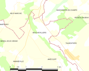
Bouchevilliers
- commune in Eure, France
- Country:
- Postal Code: 27150
- Coordinates: 49° 24' 2" N, 1° 42' 29" E
- GPS tracks (wikiloc): [Link]
- Area: 4.31 sq km
- Population: 79


Amécourt
- commune in Eure, France
- Country:
- Postal Code: 27140
- Coordinates: 49° 22' 47" N, 1° 44' 4" E
- GPS tracks (wikiloc): [Link]
- Area: 6.01 sq km
- Population: 167
- Web site: [Link]
Mesnil-sous-Vienne
- commune in Eure, France
- Country:
- Postal Code: 27150
- Coordinates: 49° 23' 9" N, 1° 40' 2" E
- GPS tracks (wikiloc): [Link]
- Area: 5.72 sq km
- Population: 118
Longchamps
- commune in Eure, France
- Country:
- Postal Code: 27150
- Coordinates: 49° 21' 40" N, 1° 37' 31" E
- GPS tracks (wikiloc): [Link]
- Area: 15.43 sq km
- Population: 610


Hébécourt
- commune in Eure, France
- Country:
- Postal Code: 27150
- Coordinates: 49° 21' 10" N, 1° 43' 36" E
- GPS tracks (wikiloc): [Link]
- Area: 11.24 sq km
- Population: 576