Maisons (Maisons)

- commune in Calvados, France
- Country:

- Postal Code: 14400
- Coordinates: 49° 19' 4" N, 0° 44' 40" E


- GPS tracks (wikiloc): [Link]
- Area: 6.67 sq km
- Population: 391
- Wikipedia en: wiki(en)
- Wikipedia: wiki(fr)
- Wikidata storage: Wikidata: Q536986
- Wikipedia Commons Category: [Link]
- Freebase ID: [/m/0307pg]
- Freebase ID: [/m/0307pg]
- GeoNames ID: Alt: [6427307]
- GeoNames ID: Alt: [6427307]
- SIREN number: [211403910]
- SIREN number: [211403910]
- BnF ID: [15247805n]
- BnF ID: [15247805n]
- INSEE municipality code: 14391
- INSEE municipality code: 14391
Shares border with regions:

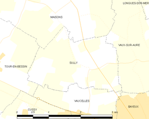
Sully
- commune in Calvados, France
- Country:
- Postal Code: 14400
- Coordinates: 49° 17' 59" N, 0° 44' 13" E
- GPS tracks (wikiloc): [Link]
- Area: 4 sq km
- Population: 140


Étréham
- commune in Calvados, France
- Country:
- Postal Code: 14400
- Coordinates: 49° 19' 19" N, 0° 47' 49" E
- GPS tracks (wikiloc): [Link]
- Area: 4.24 sq km
- Population: 336


Vaux-sur-Aure
- commune in Calvados, France
- Country:
- Postal Code: 14400
- Coordinates: 49° 18' 9" N, 0° 42' 8" E
- GPS tracks (wikiloc): [Link]
- Area: 7.6 sq km
- Population: 348

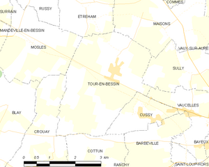
Tour-en-Bessin
- commune in Calvados, France
- Country:
- Postal Code: 14400
- Coordinates: 49° 17' 46" N, 0° 46' 44" E
- GPS tracks (wikiloc): [Link]
- Area: 10.31 sq km
- Population: 638


Commes
- commune in Calvados, France
- Country:
- Postal Code: 14520
- Coordinates: 49° 20' 16" N, 0° 44' 10" E
- GPS tracks (wikiloc): [Link]
- Area: 6.64 sq km
- Population: 392
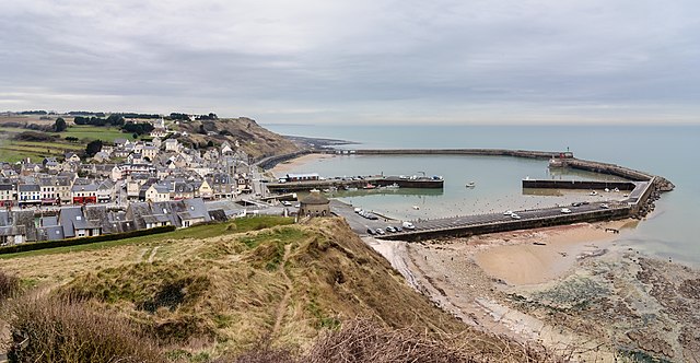

Port-en-Bessin-Huppain
- commune in Calvados, France
- Country:
- Postal Code: 14520
- Coordinates: 49° 20' 39" N, 0° 45' 19" E
- GPS tracks (wikiloc): [Link]
- Area: 7.56 sq km
- Population: 1952
- Web site: [Link]