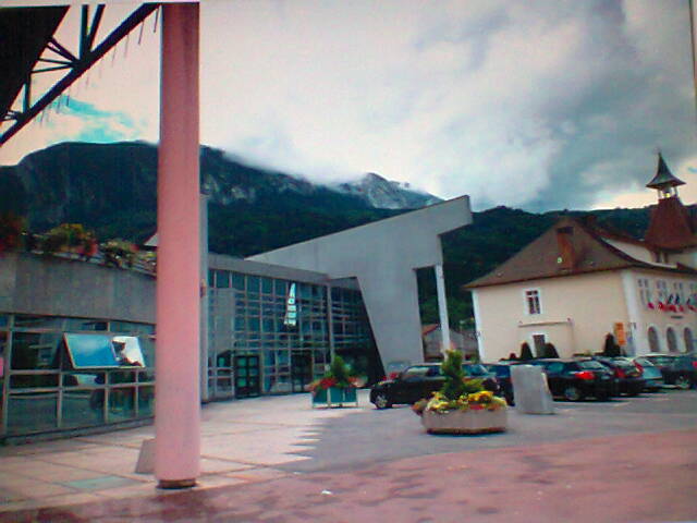
Marnaz (Marnaz)

- commune in Haute-Savoie, France
 Hiking in Marnaz
Marnaz is a picturesque town located in the Haute-Savoie region of the French Alps. It offers a range of hiking opportunities that cater to different skill levels and preferences. Here’s a breakdown of what you can expect when hiking in and around Marnaz:
Scenic Trails
-
Les Voirons: This mountain range offers several well-marked trails with varying difficulty levels. Many of these trails provide stunning views of Mont Blanc and the surrounding Alpine landscape.
-
Roche Parnal: A popular destination for hikers, Roche Parnal features a moderately challenging hike that rewards you with breathtaking panoramic views of the valley and neighboring peaks.
-
Cascades de l’Optevoz: A lovely short hike that takes you to beautiful waterfalls. This trail is suitable for families and those looking for a more gentle hike.
Hiking Season
- Summer: The best time for hiking in Marnaz is during the summer months (June to September), when trails are clear of snow and the weather is typically mild.
- Fall: Autumn can also be a stunning time for hiking as the leaves change color, especially in late September and October.
Preparation Tips
- Footwear: Wear sturdy hiking boots with good ankle support.
- Weather: Always check the weather forecast before your hike. Mountain weather can change rapidly.
- Hydration and Snacks: Carry enough water and high-energy snacks to keep your energy levels up during your hike.
- Trail Maps: Have a map or a hiking app handy to stay on track. Some trails may not have mobile service.
Safety
- Always inform someone of your hiking plans, especially if you're going solo.
- Start your hikes early in the day to avoid getting caught out after dark.
- Stay within marked trails to protect the natural environment and ensure your safety.
Local Resources
Marnaz has local tourism offices where you can gain more insight into current trail conditions, guided hikes, and maps. Consider joining local hiking groups if you're new to the area or looking for companionship on the trails.
Whether you're looking for a peaceful day hike or a more challenging adventure, Marnaz and its surroundings hold a wealth of opportunities for outdoor enthusiasts. Enjoy your hike!
- Country:

- Postal Code: 74460
- Coordinates: 46° 3' 33" N, 6° 31' 33" E


- GPS tracks (wikiloc): [Link]
- Area: 9.02 sq km
- Population: 5365
- Web site: http://www.mairiedemarnaz.fr
- Wikipedia en: wiki(en)
- Wikipedia: wiki(fr)
- Wikidata storage: Wikidata: Q899283
- Wikipedia Commons Category: [Link]
- Freebase ID: [/m/03ntzpy]
- GeoNames ID: Alt: [6442986]
- SIREN number: [217401694]
- BnF ID: [15274427r]
- PACTOLS thesaurus ID: [pcrtPPWZatlY8t]
- Twitter username: Alt: [MairiedeMarnaz]
- INSEE municipality code: 74169
Shares border with regions:
Vougy
- commune in Haute-Savoie, France
Hiking in Vougy
Vougy is a charming village located in the Haute-Savoie region of the French Alps. Surrounded by stunning landscapes, it offers a variety of hiking opportunities that cater to different skill levels and preferences....
- Country:
- Postal Code: 74130
- Coordinates: 46° 4' 0" N, 6° 29' 33" E
- GPS tracks (wikiloc): [Link]
- Area: 3.99 sq km
- Population: 1503
- Web site: [Link]


Mont-Saxonnex
- commune in Haute-Savoie, France
Hiking in Mont-Saxonnex
Mont-Saxonnex is a charming commune located in the Haute-Savoie region of the French Alps, making it an attractive destination for hiking enthusiasts. The area is known for its beautiful landscapes, diverse terrain, and panoramic views of the surrounding mountains, including the Aravis range. Here are some highlights and information about hiking in Mont-Saxonnex:...
- Country:
- Postal Code: 74130
- Coordinates: 46° 3' 16" N, 6° 29' 4" E
- GPS tracks (wikiloc): [Link]
- Area: 26.28 sq km
- Population: 1643
- Web site: [Link]


Le Reposoir
- commune in Haute-Savoie, France
Hiking in Le Reposoir
Le Reposoir is a beautiful area located in the French Alps, specifically in the Haute-Savoie region, well-known for its scenic views, lush landscapes, and quaint alpine villages. While it may not be as popular as some other hiking destinations in the Alps, it offers a variety of hiking opportunities for both beginners and experienced hikers....
- Country:
- Postal Code: 74950
- Coordinates: 46° 0' 41" N, 6° 32' 7" E
- GPS tracks (wikiloc): [Link]
- Area: 37.36 sq km
- Population: 509
- Web site: [Link]

Scionzier
- commune in Haute-Savoie, France
Hiking in Scionzier
Scionzier, located in the Haute-Savoie region of France, benefits from its proximity to the stunning French Alps, making it a great starting point for various hiking adventures. The area offers diverse trails suitable for different skill levels, from leisurely walks to more challenging treks....
- Country:
- Postal Code: 74950
- Coordinates: 46° 3' 26" N, 6° 33' 0" E
- GPS tracks (wikiloc): [Link]
- Area: 10.62 sq km
- Population: 8457
- Web site: [Link]


Thyez
- commune in Haute-Savoie, France
Hiking in Thyez
Thyez is a small commune located in the Haute-Savoie department in the Auvergne-Rhône-Alpes region of France. While it may not be as widely known for hiking as some of its neighboring areas, it is still surrounded by beautiful landscapes and offers opportunities for outdoor enthusiasts....
- Country:
- Postal Code: 74300
- Coordinates: 46° 5' 1" N, 6° 32' 28" E
- GPS tracks (wikiloc): [Link]
- Area: 9.81 sq km
- Population: 6011
- Web site: [Link]