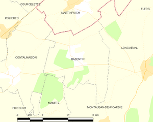
Martinpuich (Martinpuich)
- commune in Pas-de-Calais, France
- Country:

- Postal Code: 62450
- Coordinates: 50° 3' 1" N, 2° 45' 53" E


- GPS tracks (wikiloc): [Link]
- Area: 5.96 sq km
- Population: 200
- Wikipedia en: wiki(en)
- Wikipedia: wiki(fr)
- Wikidata storage: Wikidata: Q775232
- Wikipedia Commons Category: [Link]
- Freebase ID: [/m/02z7mpl]
- GeoNames ID: Alt: [6618358]
- SIREN number: [216205617]
- BnF ID: [152690029]
- INSEE municipality code: 62561
Shares border with regions:


Flers
- commune in Somme, France
- Country:

- Postal Code: 80360
- Coordinates: 50° 2' 55" N, 2° 49' 17" E


- GPS tracks (wikiloc): [Link]
- Area: 6.27 sq km
- Population: 182


Longueval
- commune in Somme, France
- Country:

- Postal Code: 80360
- Coordinates: 50° 1' 32" N, 2° 48' 13" E


- GPS tracks (wikiloc): [Link]
- AboveSeaLevel: 150 м m
- Area: 8.53 sq km
- Population: 282


Bazentin
- commune in Somme, France
- Country:

- Postal Code: 80300
- Coordinates: 50° 1' 49" N, 2° 45' 47" E


- GPS tracks (wikiloc): [Link]
- Area: 5.1 sq km
- Population: 79
- Web site: [Link]


Le Sars
- commune in Pas-de-Calais, France
- Country:

- Postal Code: 62450
- Coordinates: 50° 4' 15" N, 2° 46' 50" E


- GPS tracks (wikiloc): [Link]
- Area: 5.11 sq km
- Population: 178


Contalmaison
- commune in Somme, France
- Country:

- Postal Code: 80300
- Coordinates: 50° 1' 23" N, 2° 43' 49" E


- GPS tracks (wikiloc): [Link]
- Area: 5.67 sq km
- Population: 119
- Web site: [Link]


Courcelette
- commune in Somme, France
- Country:

- Postal Code: 80300
- Coordinates: 50° 3' 30" N, 2° 44' 49" E


- GPS tracks (wikiloc): [Link]
- Area: 4.66 sq km
- Population: 151
- Web site: [Link]
