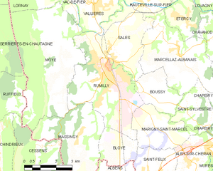
Massingy (Massingy)

- commune in Haute-Savoie, France
 Hiking in Massingy
Massingy, located in the Haute-Savoie region of the French Alps, offers a beautiful backdrop for hiking enthusiasts. This area is known for its stunning natural scenery, characterized by rolling hills, lush forests, and panoramic views of the surrounding mountains, including the nearby Mont Blanc.
Hiking Trails
While Massingy itself may not have an extensive network of well-marked trails, it is close to several hiking areas in Haute-Savoie. Here are some popular options:
-
Col de la Croix de Fer: This pass, located not too far from Massingy, offers many hiking trails with varying levels of difficulty. The views from the top are breathtaking, making it a popular spot.
-
La Tournette: Considered one of the most scenic hikes near Annecy, La Tournette provides a rewarding climb with magnificent views of Lake Annecy and the surrounding mountains.
-
Les Aravis Range: This area is renowned for its stunning landscapes and offers numerous trails that cater to different skill levels. You can enjoy alpine meadows, rocky ridges, and sweeping vistas.
-
Lake Annecy Trails: Around Lake Annecy, there are several beautiful trails that are perfect for day hikes, featuring easy walking paths along the lake and more challenging routes in the nearby hills.
What to Prepare
- Gear: Good hiking boots, weather-appropriate clothing, a first aid kit, a map or GPS, plenty of water, and snacks are essential.
- Season: The best times to hike in Haute-Savoie are late spring through early autumn, when trails are clear of snow. However, some higher elevation trails may still have snow well into June.
- Wildlife: Keep an eye out for local wildlife, including ibex and various bird species. Remember to respect nature and maintain distance from animals.
Safety Tips
- Always check the weather before heading out, as conditions can change rapidly in the mountains.
- Inform someone of your hiking plans, particularly if you’re venturing on less-frequented trails.
- Be mindful of the altitude, especially if hiking at higher elevations.
Overall, hiking in and around Massingy provides a wonderful opportunity to experience the natural beauty of the French Alps. Whether you're a seasoned hiker or a casual walker, there are plenty of options to enjoy the great outdoors.
- Country:

- Postal Code: 74150
- Coordinates: 45° 49' 47" N, 5° 55' 12" E


- GPS tracks (wikiloc): [Link]
- Area: 12.34 sq km
- Population: 847
- Wikipedia en: wiki(en)
- Wikipedia: wiki(fr)
- Wikidata storage: Wikidata: Q844636
- Wikipedia Commons Category: [Link]
- Freebase ID: [/m/03x_x3c]
- GeoNames ID: Alt: [6442987]
- SIREN number: [217401702]
- BnF ID: [152744283]
- INSEE municipality code: 74170
Shares border with regions:


Bloye
- commune in Haute-Savoie, France
Hiking in Bloye
Bloye is a charming village situated in the Haute-Savoie department of the Auvergne-Rhône-Alpes region in southeastern France. The surrounding area offers stunning natural landscapes, making it a great destination for hiking enthusiasts....
- Country:
- Postal Code: 74150
- Coordinates: 45° 49' 34" N, 5° 56' 44" E
- GPS tracks (wikiloc): [Link]
- Area: 4.4 sq km
- Population: 614


Cessens
- former commune in Savoie, France
Hiking in Cessens
Cessens is a charming village located in the Auvergne-Rhône-Alpes region of France, known for its stunning natural scenery and outdoor activities, making it a great spot for hiking enthusiasts. Here are some details about hiking in and around Cessens:...
- Country:
- Postal Code: 73410
- Coordinates: 45° 47' 58" N, 5° 52' 55" E
- GPS tracks (wikiloc): [Link]
- Area: 13.29 sq km
- Population: 403


Moye
- commune in Haute-Savoie, France
Hiking in Moye
Moye is a beautiful area for hiking, known for its diverse landscapes and natural beauty. While I don’t have specific information on a location named Moye, it typically refers to various places, sometimes in Europe or other regions. If Moye is somewhere you have in mind, here are some general tips and considerations for hiking in such an area:...
- Country:
- Postal Code: 74150
- Coordinates: 45° 52' 35" N, 5° 54' 43" E
- GPS tracks (wikiloc): [Link]
- Area: 23.8 sq km
- Population: 1030

Rumilly
- commune in Haute-Savoie, France
Hiking in Rumilly
Rumilly, located in the Haute-Savoie region of France, is a charming town surrounded by stunning landscapes that are ideal for hiking enthusiasts. Set against the backdrop of the French Alps, this area offers a variety of trails suitable for all levels of hikers, from beginners to experienced trekkers....
- Country:
- Postal Code: 74150
- Coordinates: 45° 51' 58" N, 5° 56' 40" E
- GPS tracks (wikiloc): [Link]
- Area: 16.89 sq km
- Population: 14931