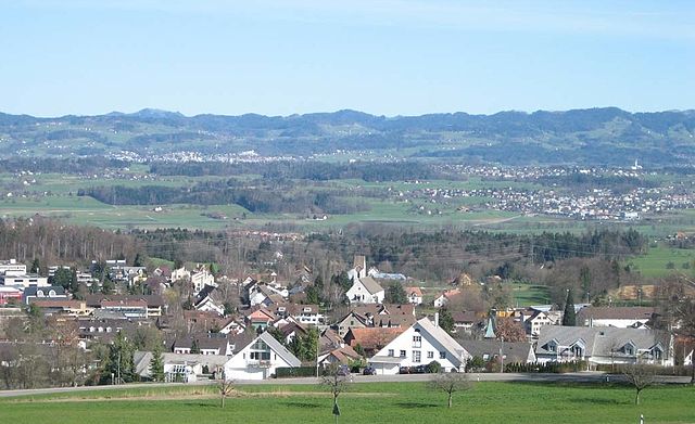
Maur (Maur)

- municipality in Switzerland
 Hiking in Maur
Hiking in Maur, Switzerland, offers a picturesque escape into the Swiss countryside, characterized by lush landscapes, quaint villages, and stunning views of the surrounding Alps.
Trails and Routes
While Maur itself is a small municipality situated in the Zurich region, it serves as a fantastic starting point for a variety of hiking trails that explore the broader Zurich area and nearby nature reserves. Some notable trails include:
-
Zurich's Uetliberg Mountain: Easily accessible from Maur, Uetliberg offers panoramic views of Lake Zurich and the Alps. There are numerous well-marked trails leading to its summit, suitable for all hiking levels.
-
Wildpark Zürich Langenberg: This wildlife park provides trails that allow hikers to experience the flora and fauna native to Switzerland, all while enjoying serene natural surroundings.
-
Felsenegg Ridge: A bit further afield, this trail boasts breathtaking vistas over the lake and distant mountains, making it a rewarding hike for those willing to venture further.
Best Time to Hike
The best time for hiking around Maur is during the late spring through early autumn (May to October) when the weather is typically mild, and the trails are more accessible. However, always check the local weather conditions and trail status before heading out, especially in early spring or late autumn, when trails may be muddy or snowy.
Hiking Tips
- Preparation: Bring plenty of water, snacks, and appropriate clothing for changing weather conditions. Weather can change quickly in the mountains.
- Maps and Navigation: Carry a physical map or download a reliable hiking app. While trails are generally well-marked, having a map ensures you won’t lose your way.
- Local Regulations: Observe local wildlife and respect the environment. Stay on marked trails to protect native flora and fauna.
- Safety: Whether hiking alone or in a group, let someone know your plans and expected return time.
Amenities
Maur features a few local eateries and shops where you can grab a bite after a hike, and being near Zurich means you have access to more extensive services including accommodations if you're planning a longer stay.
Hiking in Maur is not just about the trails; it's about immersing yourself in the beautiful Swiss landscape and experiencing the tranquility of nature. Enjoy your adventure!
- Country:

- Postal Code: 8124
- Local Dialing Code: 044
- Licence Plate Code: ZH
- Coordinates: 47° 20' 30" N, 8° 40' 13" E


- GPS tracks (wikiloc): [Link]
- AboveSeaLevel: 478 м m
- Area: 18.40 sq km
- Population: 10148
- Web site: http://www.maur.ch
- Wikipedia en: wiki(en)
- Wikipedia: wiki(de)
- Wikidata storage: Wikidata: Q64857
- Wikipedia Commons Category: [Link]
- Freebase ID: [/m/0gvk63]
- GeoNames ID: Alt: [7286464]
- VIAF ID: Alt: [136030592]
- OSM relation ID: [1682164]
- archINFORM location ID: [6259]
- MusicBrainz area ID: [7dafcd86-5128-4680-b0ce-bf4a66addafa]
- HDS ID: [132]
- Swiss municipality code: [0195]
Shares border with regions:


Zollikon
- municipality in Switzerland
Hiking in Zollikon
Hiking in Zollikon, a charming municipality located just outside of Zurich, Switzerland, offers a variety of scenic trails suitable for all levels of hikers. Nestled alongside the shores of Lake Zurich and surrounded by the picturesque Swiss landscape, Zollikon provides beautiful views and a tranquil atmosphere....
- Country:
- Postal Code: 8702
- Local Dialing Code: 043; 044
- Licence Plate Code: ZH
- Coordinates: 47° 20' 36" N, 8° 35' 41" E
- GPS tracks (wikiloc): [Link]
- AboveSeaLevel: 603 м m
- Area: 7.84 sq km
- Population: 12983
- Web site: [Link]

Egg
- municipality in Switzerland
Hiking in Egg
Egg, located in the Canton of Zurich in Switzerland, is a charming village nestled in the lush landscapes of the Zürcher Oberland. It offers a variety of hiking options suitable for all skill levels. Here are some highlights of hiking in and around Egg:...
- Country:
- Postal Code: 8132
- Local Dialing Code: 01; 043; 044
- Licence Plate Code: ZH
- Coordinates: 47° 18' 7" N, 8° 41' 26" E
- GPS tracks (wikiloc): [Link]
- AboveSeaLevel: 545 м m
- Area: 14.48 sq km
- Population: 8452
- Web site: [Link]


Greifensee
- municipality in Switzerland
Hiking in Greifensee
Hiking around Greifensee, located just outside Zürich, offers a wonderful mix of scenic views, nature, and cultural experiences. The lake itself is a popular destination for outdoor enthusiasts, and the surrounding trails provide a variety of options suitable for different skill levels. Here are some highlights about hiking in this beautiful area:...
- Country:
- Postal Code: 8606
- Local Dialing Code: 044
- Licence Plate Code: ZH
- Coordinates: 47° 21' 58" N, 8° 40' 43" E
- GPS tracks (wikiloc): [Link]
- AboveSeaLevel: 439 м m
- Area: 2.30 sq km
- Population: 5345
- Web site: [Link]


Mönchaltorf
- municipality in Switzerland
Hiking in Mönchaltorf
Mönchaltorf is a charming village located in the Zurich region of Switzerland, surrounded by beautiful landscapes and offering several hiking opportunities. The area is characterized by its scenic hills, forests, and agricultural landscapes, making it a perfect destination for outdoor enthusiasts....
- Country:
- Postal Code: 8617
- Local Dialing Code: 044
- Licence Plate Code: ZH
- Coordinates: 47° 18' 41" N, 8° 43' 20" E
- GPS tracks (wikiloc): [Link]
- AboveSeaLevel: 442 м m
- Area: 7.62 sq km
- Population: 3715
- Web site: [Link]


Zumikon
- municipality in Switzerland
Hiking in Zumikon
Zumikon, located in the Zurich district of Switzerland, offers a peaceful hiking experience with beautiful landscapes and easy access to nature. The region is known for its picturesque countryside, forests, and proximity to Lake Zurich, making it an ideal location for both casual and more experienced hikers....
- Country:
- Postal Code: 8126
- Local Dialing Code: 01
- Licence Plate Code: ZH
- Coordinates: 47° 20' 3" N, 8° 37' 34" E
- GPS tracks (wikiloc): [Link]
- AboveSeaLevel: 681 м m
- Area: 5.44 sq km
- Population: 5120
- Web site: [Link]


Küsnacht
- municipality in Switzerland
Hiking in Küsnacht
Küsnacht, located on the shores of Lake Zurich in Switzerland, offers a range of beautiful hiking opportunities, making it an attractive destination for both novice and experienced hikers. Here are some highlights of hiking in and around Küsnacht:...
- Country:
- Postal Code: 8700
- Local Dialing Code: 01
- Licence Plate Code: ZH
- Coordinates: 47° 19' 5" N, 8° 34' 57" E
- GPS tracks (wikiloc): [Link]
- AboveSeaLevel: 427 м m
- Area: 12.35 sq km
- Population: 14250
- Web site: [Link]


Herrliberg
- municipality in Switzerland
Hiking in Herrliberg
Herrliberg is a picturesque municipality located on the shores of Lake Zurich in Switzerland, nestled amid the breathtaking landscapes of the Swiss Alps. Hiking in Herrliberg offers a wonderful combination of scenic beauty, tranquil lakeside paths, and stunning mountain views....
- Country:
- Postal Code: 8704
- Local Dialing Code: 044; 043
- Licence Plate Code: ZH
- Coordinates: 47° 17' 50" N, 8° 37' 49" E
- GPS tracks (wikiloc): [Link]
- AboveSeaLevel: 646 м m
- Area: 8.97 sq km
- Population: 6290
- Web site: [Link]

Zürich
- capital of the canton of Zürich, Switzerland
Hiking in Zürich
Hiking in Zürich offers a wonderful mix of urban convenience and stunning natural landscapes. The city is situated near the edge of the Swiss Alps, providing easy access to numerous trails that cater to all levels of hikers, from beginners to experienced trekkers....
- Country:
- Postal Code: 8064; 8063; 8057; 8055; 8053; 8052; 8051; 8050; 8049; 8046; 8045; 8044; 8041; 8038; 8037; 8032; 8008; 8006; 8005; 8004; 8003; 8002; 8001; 8000
- Local Dialing Code: 044; 043
- Licence Plate Code: ZH
- Coordinates: 47° 22' 43" N, 8° 32' 24" E
- GPS tracks (wikiloc): [Link]
- AboveSeaLevel: 408 м m
- Area: 87.88 sq km
- Population: 409241
- Web site: [Link]