Meigneux (Meigneux)

- commune in Somme, France
- Country:

- Postal Code: 80290
- Coordinates: 49° 45' 53" N, 1° 53' 41" E


- GPS tracks (wikiloc): [Link]
- Area: 3.97 sq km
- Population: 172
- Wikipedia en: wiki(en)
- Wikipedia: wiki(fr)
- Wikidata storage: Wikidata: Q395585
- Wikipedia Commons Category: [Link]
- Freebase ID: [/m/03qmq42]
- GeoNames ID: Alt: [6444604]
- SIREN number: [218004984]
- BnF ID: [15277003c]
- INSEE municipality code: 80525
Shares border with regions:


Hescamps
- commune in Somme, France
- Country:
- Postal Code: 80290
- Coordinates: 49° 43' 43" N, 1° 52' 16" E
- GPS tracks (wikiloc): [Link]
- AboveSeaLevel: 200 м m
- Area: 34.56 sq km
- Population: 523

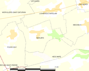
Marlers
- commune in Somme, France
- Country:
- Postal Code: 80590
- Coordinates: 49° 45' 41" N, 1° 50' 56" E
- GPS tracks (wikiloc): [Link]
- Area: 3.93 sq km
- Population: 139


Caulières
- commune in Somme, France
- Country:
- Postal Code: 80590
- Coordinates: 49° 46' 48" N, 1° 53' 22" E
- GPS tracks (wikiloc): [Link]
- Area: 5.41 sq km
- Population: 201

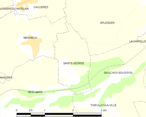
Sainte-Segrée
- commune in Somme, France
- Country:
- Postal Code: 80290
- Coordinates: 49° 45' 20" N, 1° 54' 45" E
- GPS tracks (wikiloc): [Link]
- Area: 2.27 sq km
- Population: 60


Lignières-Châtelain
- commune in Somme, France
- Country:
- Postal Code: 80590
- Coordinates: 49° 46' 30" N, 1° 51' 47" E
- GPS tracks (wikiloc): [Link]
- Area: 6.54 sq km
- Population: 374
- Web site: [Link]


Éplessier
- commune in Somme, France
- Country:
- Postal Code: 80290
- Coordinates: 49° 46' 59" N, 1° 57' 25" E
- GPS tracks (wikiloc): [Link]
- Area: 14.09 sq km
- Population: 378
- Web site: [Link]