Melay (Melay)
- former commune in Maine-et-Loire, France
- Country:

- Postal Code: 49120
- Coordinates: 47° 10' 57" N, 0° 41' 47" E


- GPS tracks (wikiloc): [Link]
- Population: 1657
- Wikipedia en: wiki(en)
- Wikipedia: wiki(fr)
- Wikidata storage: Wikidata: Q1384734
- Wikipedia Commons Category: [Link]
- Freebase ID: [/m/03qf5_9]
- Freebase ID: [/m/03qf5_9]
- Library of Congress authority ID: Alt: [no2013020676]
- Library of Congress authority ID: Alt: [no2013020676]
- INSEE municipality code: 49199
- INSEE municipality code: 49199
Shares border with regions:


Cossé-d'Anjou
- former commune in Maine-et-Loire, France
- Country:
- Postal Code: 49120
- Coordinates: 47° 9' 46" N, 0° 40' 40" E
- GPS tracks (wikiloc): [Link]
- Area: 13.29 sq km
- Population: 423

Saint-Georges-des-Gardes
- former commune in Maine-et-Loire, France
- Country:
- Postal Code: 49120
- Coordinates: 47° 9' 0" N, 0° 45' 33" E
- GPS tracks (wikiloc): [Link]
- AboveSeaLevel: 171 м m
- Area: 32.49 sq km
- Population: 1598

Chemillé
- former commune in Maine-et-Loire, France
- Country:
- Postal Code: 49120
- Coordinates: 47° 12' 47" N, 0° 43' 33" E
- GPS tracks (wikiloc): [Link]
- Population: 7285

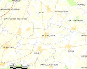
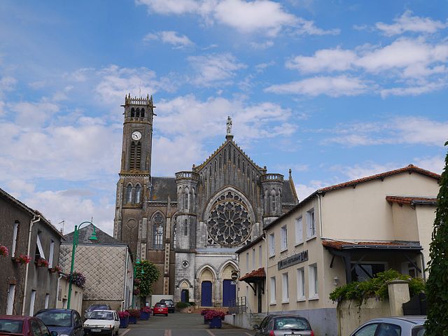
La Tourlandry
- former commune in Maine-et-Loire, France
- Country:
- Postal Code: 49120
- Coordinates: 47° 8' 34" N, 0° 41' 52" E
- GPS tracks (wikiloc): [Link]
- Area: 19.34 sq km
- Population: 1409