Merpins (Merpins)

- commune in Charente, France
- Country:

- Postal Code: 16100
- Coordinates: 45° 40' 29" N, 0° 21' 25" E


- GPS tracks (wikiloc): [Link]
- Area: 10.46 sq km
- Population: 1102
- Wikipedia en: wiki(en)
- Wikipedia: wiki(fr)
- Wikidata storage: Wikidata: Q835237
- Wikipedia Commons Category: [Link]
- Freebase ID: [/m/03mcc42]
- GeoNames ID: Alt: [2994328]
- SIREN number: [211602172]
- BnF ID: [152486567]
- Digital Atlas of the Roman Empire ID: [13057]
- INSEE municipality code: 16217
Shares border with regions:


Saint-Laurent-de-Cognac
- commune in Charente, France
- Country:
- Postal Code: 16100
- Coordinates: 45° 41' 48" N, 0° 24' 30" E
- GPS tracks (wikiloc): [Link]
- Area: 10.87 sq km
- Population: 837

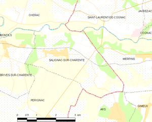
Salignac-sur-Charente
- commune in Charente-Maritime, France
- Country:
- Postal Code: 17800
- Coordinates: 45° 40' 20" N, 0° 25' 23" E
- GPS tracks (wikiloc): [Link]
- Area: 10.22 sq km
- Population: 611

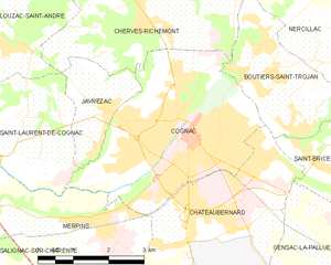
Cognac
- commune in Charente, France
- Country:
- Postal Code: 16100
- Coordinates: 45° 41' 45" N, 0° 19' 45" E
- GPS tracks (wikiloc): [Link]
- AboveSeaLevel: 27 м m
- Area: 15.5 sq km
- Population: 18654
- Web site: [Link]


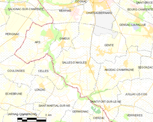
Ars
- commune in Charente, France
- Country:
- Postal Code: 16130
- Coordinates: 45° 38' 35" N, 0° 22' 56" E
- GPS tracks (wikiloc): [Link]
- Area: 11.4 sq km
- Population: 736
- Web site: [Link]


Châteaubernard
- commune in Charente, France
- Country:
- Postal Code: 16100
- Coordinates: 45° 40' 21" N, 0° 18' 52" E
- GPS tracks (wikiloc): [Link]
- AboveSeaLevel: 40 м m
- Area: 13.31 sq km
- Population: 3625
- Web site: [Link]


Gimeux
- commune in Charente, France
- Country:
- Postal Code: 16130
- Coordinates: 45° 38' 8" N, 0° 22' 11" E
- GPS tracks (wikiloc): [Link]
- Area: 7.4 sq km
- Population: 709

Salles-d'Angles
- commune in Charente, France
- Country:
- Postal Code: 16130
- Coordinates: 45° 37' 5" N, 0° 20' 0" E
- GPS tracks (wikiloc): [Link]
- Area: 21.8 sq km
- Population: 1036