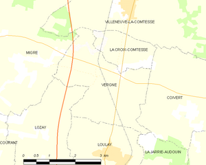
Migré (Migré)

- commune in Charente-Maritime, France
- Country:

- Postal Code: 17330
- Coordinates: 46° 4' 28" N, 0° 33' 28" E


- GPS tracks (wikiloc): [Link]
- Area: 14.3 sq km
- Population: 313
- Web site: http://www.migre.fr
- Wikipedia en: wiki(en)
- Wikipedia: wiki(fr)
- Wikidata storage: Wikidata: Q1144543
- Wikipedia Commons Category: [Link]
- Freebase ID: [/m/03mch_3]
- GeoNames ID: Alt: [2993906]
- SIREN number: [211702345]
- INSEE municipality code: 17234
Shares border with regions:


Dœuil-sur-le-Mignon
- commune in Charente-Maritime, France
- Country:
- Postal Code: 17330
- Coordinates: 46° 7' 51" N, 0° 32' 40" E
- GPS tracks (wikiloc): [Link]
- Area: 19.33 sq km
- Population: 342
- Web site: [Link]


Bernay-Saint-Martin
- commune in Charente-Maritime, France
- Country:
- Postal Code: 17330
- Coordinates: 46° 3' 52" N, 0° 37' 13" E
- GPS tracks (wikiloc): [Link]
- Area: 24.9 sq km
- Population: 784
- Web site: [Link]


Saint-Félix
- commune in Charente-Maritime, France
- Country:
- Postal Code: 17330
- Coordinates: 46° 5' 21" N, 0° 35' 59" E
- GPS tracks (wikiloc): [Link]
- Area: 15.23 sq km
- Population: 300


Courant
- commune in Charente-Maritime, France
- Country:
- Postal Code: 17330
- Coordinates: 46° 2' 32" N, 0° 34' 25" E
- GPS tracks (wikiloc): [Link]
- Area: 15.46 sq km
- Population: 400


Villeneuve-la-Comtesse
- commune in Charente-Maritime, France
- Country:
- Postal Code: 17330
- Coordinates: 46° 5' 54" N, 0° 30' 15" E
- GPS tracks (wikiloc): [Link]
- Area: 15.9 sq km
- Population: 747


Lozay
- commune in Charente-Maritime, France
- Country:
- Postal Code: 17330
- Coordinates: 46° 2' 29" N, 0° 32' 50" E
- GPS tracks (wikiloc): [Link]
- Area: 11.85 sq km
- Population: 146
- Web site: [Link]

Vergné
- commune in Charente-Maritime, France
- Country:
- Postal Code: 17330
- Coordinates: 46° 4' 30" N, 0° 30' 41" E
- GPS tracks (wikiloc): [Link]
- Area: 8 sq km
- Population: 141