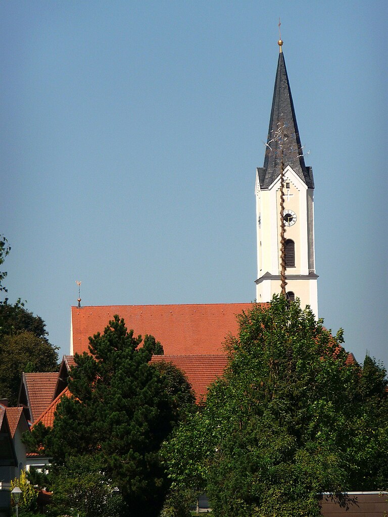
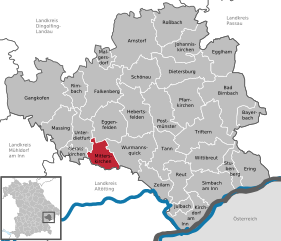
Mitterskirchen (Mitterskirchen)
- municipality of Germany
Mitterskirchen, a small village located in the scenic region of Bavaria, Germany, offers a wonderful backdrop for hiking enthusiasts. Nestled among rolling hills and lush forests, the area is known for its natural beauty and tranquility, making it an ideal location for outdoor activities.
Hiking Trails
While there might not be extensive established hiking trails specifically within Mitterskirchen, the surrounding region offers various options:
-
Local Trails: You can explore local paths that weave through picturesque landscapes, farmland, and forested areas. These trails are often less crowded, providing a peaceful hiking experience.
-
Surrounding Nature Reserves: Head towards nearby nature reserves and parks, such as the Bavarian Forest National Park or the rolling hills of the Lower Bavarian region. These areas feature marked trails suitable for different skill levels, allowing you to take in the stunning natural scenery.
-
Historical Routes: Some routes in the vicinity may offer cultural or historical significance. Look for paths that lead to local landmarks, old churches, or traditional Bavarian villages.
Preparation
-
Maps and Navigation: Bring a detailed local map or use a hiking app to help navigate trails. It's advisable to download offline maps since cell service can be limited in rural areas.
-
Weather Gear: The weather can change quickly, especially in forested or elevated areas. Ensure you bring appropriate clothing and gear for protection against rain or wind.
-
Footwear: Sturdy hiking boots are essential to navigate various terrains, from grass paths to potentially rocky areas.
Safety Tips
- Stay Hydrated: Carry enough water, particularly on warmer days.
- Tell Someone Your Plans: Let a friend or family member know your hiking route and expected return time as a safety measure.
- Wildlife Awareness: Be respectful of local wildlife and maintain a safe distance from any animals you may encounter.
Conclusion
Hiking in and around Mitterskirchen provides an enriching experience, blending physical activity with the enjoyment of nature and local culture. Whether you're interested in a short nature stroll or a more extended hike through the Bavarian countryside, there are plenty of options to enjoy the great outdoors.
- Country:

- Postal Code: 84335
- Local Dialing Code: 08725
- Licence Plate Code: PAN
- Coordinates: 48° 21' 0" N, 12° 44' 0" E


- GPS tracks (wikiloc): [Link]
- AboveSeaLevel: 433 м m
- Area: 24.63 sq km
- Population: 1612
- Web site: http://www.mitterskirchen.de
- Wikipedia en: wiki(en)
- Wikipedia: wiki(de)
- Wikidata storage: Wikidata: Q257401
- Wikipedia Commons Category: [Link]
- Freebase ID: [/m/02q837g]
- GeoNames ID: Alt: [2870359]
- VIAF ID: Alt: [234309690]
- OSM relation ID: [957072]
- GND ID: Alt: [4358646-6]
- Bavarikon ID: [ODB_A00001626]
- German municipality key: 09277134
Shares border with regions:


Erlbach
- municipality of Germany
Erlbach, located in Bavaria, Germany, is a charming spot for hiking enthusiasts. Nestled in the scenic landscape of the Bavarian Forest, Erlbach offers a variety of trails that cater to different skill levels, making it ideal for both novices and experienced hikers....
- Country:

- Postal Code: 84567
- Local Dialing Code: 08670
- Coordinates: 48° 18' 0" N, 12° 47' 0" E


- GPS tracks (wikiloc): [Link]
- AboveSeaLevel: 451 м m
- Area: 28.14 sq km
- Population: 1200
- Web site: [Link]


Pleiskirchen
- municipality of Germany
Pleiskirchen is a charming municipality located in Bavaria, Germany. The surrounding region offers some lovely hiking opportunities, characterized by rolling hills, picturesque landscapes, and beautiful natural scenery. Here are a few key points to consider when hiking in and around Pleiskirchen:...
- Country:

- Postal Code: 84568
- Local Dialing Code: 08635
- Coordinates: 48° 18' 0" N, 12° 36' 0" E


- GPS tracks (wikiloc): [Link]
- AboveSeaLevel: 450 м m
- Area: 52.59 sq km
- Population: 2127
- Web site: [Link]


Eggenfelden
- town in the district of Rottal-Inn, Regierungsbezirk Niederbayern, Bavaria, Germany
Eggenfelden is a charming town located in Bavaria, Germany, and it's surrounded by picturesque landscapes that make it a delightful destination for hiking enthusiasts. While the town itself isn’t known for high mountain trails, it offers various routes that can be enjoyed by hikers of all skill levels. Here are a few highlights and tips for hiking in and around Eggenfelden:...
- Country:

- Postal Code: 84307
- Local Dialing Code: 08721
- Coordinates: 48° 23' 57" N, 12° 44' 53" E


- GPS tracks (wikiloc): [Link]
- AboveSeaLevel: 404 м m
- Area: 44.35 sq km
- Population: 10897
- Web site: [Link]


Reischach
- municipality of Germany
Reischach, a charming village located in the South Tyrol region of northern Italy, is a popular destination for hiking enthusiasts. Nestled in the beautiful Dolomites, it offers stunning scenery, diverse trails, and a variety of difficulty levels suitable for hikers of all ages and skill levels....
- Country:

- Postal Code: 84571
- Local Dialing Code: 08670
- Coordinates: 48° 17' 0" N, 12° 44' 0" E


- GPS tracks (wikiloc): [Link]
- AboveSeaLevel: 419 м m
- Area: 28.46 sq km
- Population: 2309
- Web site: [Link]


Geratskirchen
- municipality of Germany
Geratskirchen is a small municipality located in Bavaria, Germany, known for its picturesque landscapes and scenic hiking trails. While it may not be as well-known as larger regions, it offers a charming outdoor experience for hikers looking to explore the natural beauty of Bavaria....
- Country:

- Postal Code: 84552
- Local Dialing Code: 08728
- Licence Plate Code: PAN
- Coordinates: 48° 20' 0" N, 12° 40' 0" E


- GPS tracks (wikiloc): [Link]
- AboveSeaLevel: 441 м m
- Area: 12.89 sq km
- Population: 597
- Web site: [Link]


Unterdietfurt
- municipality of Germany
Unterdietfurt, a small village in Bavaria, Germany, offers beautiful landscapes and scenic trails perfect for hiking enthusiasts. The area is characterized by its rolling hills, lush forests, and quaint rural surroundings, making it an ideal location for both casual walkers and more experienced hikers....
- Country:

- Postal Code: 84339
- Local Dialing Code: 08724
- Licence Plate Code: PAN
- Coordinates: 48° 23' 0" N, 12° 39' 0" E


- GPS tracks (wikiloc): [Link]
- AboveSeaLevel: 420 м m
- Area: 27.48 sq km
- Population: 1844
- Web site: [Link]


Wurmannsquick
- municipality of Germany
Wurmannsquick is a small municipality in Bavaria, Germany, known for its picturesque countryside and forests, making it a lovely destination for hiking enthusiasts. The surrounding area offers a variety of trails suitable for different skill levels, from easy walks to more challenging hikes....
- Country:

- Postal Code: 84329
- Local Dialing Code: 08725
- Licence Plate Code: PAN
- Coordinates: 48° 21' 0" N, 12° 47' 0" E


- GPS tracks (wikiloc): [Link]
- AboveSeaLevel: 500 м m
- Area: 49.19 sq km
- Population: 3239
- Web site: [Link]

