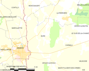
Montgaudry (Montgaudry)

- commune in Orne, France
- Country:

- Postal Code: 61360
- Coordinates: 48° 24' 22" N, 0° 24' 7" E


- GPS tracks (wikiloc): [Link]
- Area: 11.05 sq km
- Population: 85
- Wikipedia en: wiki(en)
- Wikipedia: wiki(fr)
- Wikidata storage: Wikidata: Q248732
- Wikipedia Commons Category: [Link]
- Freebase ID: [/m/03qgqs_]
- Freebase ID: [/m/03qgqs_]
- GeoNames ID: Alt: [6612701]
- GeoNames ID: Alt: [6612701]
- SIREN number: [216102863]
- SIREN number: [216102863]
- BnF ID: [152682180]
- BnF ID: [152682180]
- INSEE municipality code: 61286
- INSEE municipality code: 61286
Shares border with regions:


La Perrière
- former commune in Orne, France
- Country:
- Postal Code: 61360
- Coordinates: 48° 23' 22" N, 0° 26' 32" E
- GPS tracks (wikiloc): [Link]
- Area: 16.16 sq km
- Population: 253


Pervenchères
- commune in Orne, France
- Country:
- Postal Code: 61360
- Coordinates: 48° 26' 18" N, 0° 25' 32" E
- GPS tracks (wikiloc): [Link]
- Area: 28.35 sq km
- Population: 337

Suré
- commune in Orne, France
- Country:
- Postal Code: 61360
- Coordinates: 48° 22' 8" N, 0° 23' 53" E
- GPS tracks (wikiloc): [Link]
- Area: 17.44 sq km
- Population: 278


Contilly
- commune in Sarthe, France
- Country:
- Postal Code: 72600
- Coordinates: 48° 24' 3" N, 0° 22' 9" E
- GPS tracks (wikiloc): [Link]
- Area: 12.48 sq km
- Population: 141


Marollette
- commune in Sarthe, France
- Country:
- Postal Code: 72600
- Coordinates: 48° 22' 11" N, 0° 21' 4" E
- GPS tracks (wikiloc): [Link]
- AboveSeaLevel: 175 м m
- Area: 5.7 sq km
- Population: 148