Montmin (Montmin)

- former commune in Haute-Savoie, France
 Hiking in Montmin
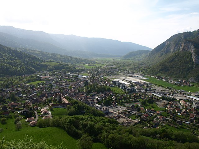
Montmin, located in the Haute-Savoie region of France, is a picturesque village nestled between Lake Annecy and the surrounding mountains, offering stunning scenery and a variety of hiking opportunities. Here are some highlights and tips for hiking in the Montmin area:
Trails and Routes
-
Col de la Forclaz: This is one of the most popular hiking starting points in Montmin. The trails here provide spectacular views of Lake Annecy and the surrounding mountains. There are several routes to choose from, ranging from easy walks to more challenging hikes.
-
Hike to Mont Miné: This is a moderate hike that starts from Col de la Forclaz and takes you to the summit of Mont Miné. The trail offers panoramic views and a rewarding summit experience.
-
Les Dents de Lanfon: This is a more challenging trek that involves climbing to the summit of Dents de Lanfon. The hike is steep but offers breathtaking views of the landscape, including Lake Annecy.
-
Lac de la Tournette: This trail leads to a beautiful alpine lake, providing opportunities for picnicking and enjoying the serene environment.
Best Time to Hike
- Spring (April to June): The weather starts to warm up, and wildflowers begin to bloom. This is a great time for milder hikes.
- Summer (July to August): The trails are accessible, but it can get quite busy. Early mornings or late afternoons are ideal for avoiding crowds.
- Autumn (September to October): The fall foliage provides stunning vistas and cooler temperatures make for comfortable hiking conditions.
- Winter (November to March): Some trails may be accessible for snowshoeing or winter walks, but be prepared for colder conditions and check the weather carefully.
Recommendations
- Gear Up: Always wear sturdy hiking boots and bring layers, as the weather can change rapidly in the mountains.
- Hydration and Snacks: Carry enough water and snacks to keep your energy up, especially on longer hikes.
- Maps and Navigation: It’s advisable to have a good map of the area or use a reliable hiking app for navigation.
- Wildlife and Nature: Keep an eye out for local wildlife and take a moment to enjoy the rich biodiversity of the region.
Local Amenities
The village of Montmin has some charming accommodations, local restaurants, and shops where you can find provisions. It’s a great opportunity to experience local cuisine after a day of hiking.
Overall, Montmin offers an incredible hiking experience with its stunning Alpine scenery, diverse trails, and charming village ambiance, making it a fantastic destination for both novice and experienced hikers.
- Country:

- Postal Code: 74210
- Coordinates: 45° 48' 9" N, 6° 15' 52" E


- GPS tracks (wikiloc): [Link]
- Area: 16.29 sq km
- Population: 312
- Wikipedia en: wiki(en)
- Wikipedia: wiki(fr)
- Wikidata storage: Wikidata: Q736450
- Wikipedia Commons Category: [Link]
- Freebase ID: [/m/01wtxs]
- GeoNames ID: Alt: [6443001]
- BnF ID: [15274445p]
- VIAF ID: Alt: [238110218]
- INSEE municipality code: 74187
Shares border with regions:


Serraval
- commune in Haute-Savoie, France
Hiking in Serraval
Serraval, located in the French Alps, offers a stunning landscape for hiking enthusiasts. The region is known for its beautiful trails, breathtaking vistas, and diverse flora and fauna. Whether you are a beginner or an experienced hiker, there's something for everyone....
- Country:
- Postal Code: 74230
- Coordinates: 45° 48' 11" N, 6° 20' 23" E
- GPS tracks (wikiloc): [Link]
- Area: 19.73 sq km
- Population: 665


Doussard
- commune in Haute-Savoie, France
Hiking in Doussard
Doussard, located in the Haute-Savoie region of France, is a picturesque town situated on the shores of Lake Annecy, surrounded by stunning alpine scenery. It serves as an excellent base for various outdoor activities, including hiking. Here are some aspects to consider if you're planning a hiking trip in Doussard:...
- Country:
- Postal Code: 74210
- Coordinates: 45° 46' 32" N, 6° 13' 14" E
- GPS tracks (wikiloc): [Link]
- Area: 20.14 sq km
- Population: 3625
- Web site: [Link]


Les Clefs
- commune in Haute-Savoie, France
Hiking in Les Clefs
Les Clefs is a charming village located in the Haute-Savoie region of the French Alps, making it a great destination for hiking enthusiasts. The area offers stunning alpine scenery, lush forests, and various trails suitable for different skill levels. Here are some highlights for hiking in Les Clefs:...
- Country:
- Postal Code: 74230
- Coordinates: 45° 51' 40" N, 6° 19' 41" E
- GPS tracks (wikiloc): [Link]
- Area: 18.47 sq km
- Population: 628

Faverges
- former commune in Haute-Savoie, France
Hiking in Faverges
Faverges is a charming town located in the Haute-Savoie region of France, near the stunning French Alps. Hiking in and around Faverges offers a variety of options for outdoor enthusiasts, ranging from easy walks to more challenging trails that reward you with breathtaking views and landscapes....
- Country:
- Postal Code: 74210
- Coordinates: 45° 44' 48" N, 6° 17' 38" E
- GPS tracks (wikiloc): [Link]
- Area: 25.86 sq km
- Population: 6952
- Web site: [Link]


Saint-Ferréol
- commune in Haute-Savoie, France
Hiking in Saint-Ferréol
Saint-Ferréol, located in the Haute-Savoie region of the French Alps, offers stunning landscapes and a range of hiking opportunities for outdoor enthusiasts. Here are some key points to know about hiking in this picturesque area:...
- Country:
- Postal Code: 74210
- Coordinates: 45° 45' 58" N, 6° 18' 24" E
- GPS tracks (wikiloc): [Link]
- Area: 16.79 sq km
- Population: 834