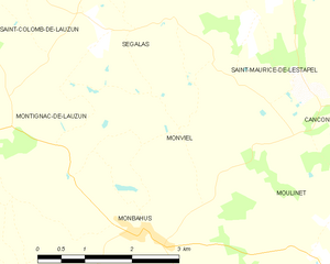
Monviel (Monviel)
- commune in Lot-et-Garonne, France
- Country:

- Postal Code: 47290
- Coordinates: 44° 34' 8" N, 0° 32' 41" E


- GPS tracks (wikiloc): [Link]
- Area: 6.23 sq km
- Population: 83
- Wikipedia en: wiki(en)
- Wikipedia: wiki(fr)
- Wikidata storage: Wikidata: Q194159
- Wikipedia Commons Category: [Link]
- Freebase ID: [/m/03qm28w]
- GeoNames ID: Alt: [6435020]
- SIREN number: [214701922]
- BnF ID: [15261273f]
- INSEE municipality code: 47192
Shares border with regions:
Monbahus
- commune in Lot-et-Garonne, France
- Country:

- Postal Code: 47290
- Coordinates: 44° 32' 54" N, 0° 32' 6" E


- GPS tracks (wikiloc): [Link]
- Area: 31.97 sq km
- Population: 606


Moulinet
- commune in Lot-et-Garonne, France
- Country:

- Postal Code: 47290
- Coordinates: 44° 32' 29" N, 0° 34' 55" E


- GPS tracks (wikiloc): [Link]
- Area: 14.57 sq km
- Population: 191
Saint-Maurice-de-Lestapel
- commune in Lot-et-Garonne, France
- Country:

- Postal Code: 47290
- Coordinates: 44° 34' 26" N, 0° 34' 6" E


- GPS tracks (wikiloc): [Link]
- Area: 7.79 sq km
- Population: 110


Montignac-de-Lauzun
- commune in Lot-et-Garonne, France
- Country:

- Postal Code: 47800
- Coordinates: 44° 34' 24" N, 0° 27' 50" E


- GPS tracks (wikiloc): [Link]
- AboveSeaLevel: 190 м m
- Area: 20.46 sq km
- Population: 280


Ségalas
- commune in Lot-et-Garonne, France
- Country:

- Postal Code: 47410
- Coordinates: 44° 35' 14" N, 0° 31' 52" E


- GPS tracks (wikiloc): [Link]
- Area: 12.84 sq km
- Population: 158
