Mougon (Mougon)

- former commune in Deux-Sèvres, France
- Country:

- Postal Code: 79370
- Coordinates: 46° 17' 45" N, 0° 17' 17" E


- GPS tracks (wikiloc): [Link]
- Area: 21.29 sq km
- Population: 2134
- Wikipedia en: wiki(en)
- Wikipedia: wiki(fr)
- Wikidata storage: Wikidata: Q1344498
- Wikipedia Commons Category: [Link]
- Freebase ID: [/m/03mg38t]
- GeoNames ID: Alt: [2991549]
- BnF ID: [15276320j]
- INSEE municipality code: 79185
Shares border with regions:


Aigonnay
- commune in Deux-Sèvres, France
- Country:
- Postal Code: 79370
- Coordinates: 46° 19' 47" N, 0° 15' 30" E
- GPS tracks (wikiloc): [Link]
- Area: 14.05 sq km
- Population: 643


Vouillé
- commune in Deux-Sèvres, France
- Country:
- Postal Code: 79230
- Coordinates: 46° 18' 59" N, 0° 21' 43" E
- GPS tracks (wikiloc): [Link]
- Area: 22.3 sq km
- Population: 3281
Fressines
- commune in Deux-Sèvres, France
- Country:
- Postal Code: 79370
- Coordinates: 46° 19' 20" N, 0° 17' 49" E
- GPS tracks (wikiloc): [Link]
- Area: 9.61 sq km
- Population: 1644

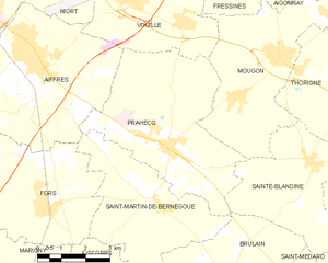
Prahecq
- commune in Deux-Sèvres, France
- Country:
- Postal Code: 79230
- Coordinates: 46° 15' 31" N, 0° 20' 45" E
- GPS tracks (wikiloc): [Link]
- Area: 24.95 sq km
- Population: 2135
Thorigné
- former commune in Deux-Sèvres, France
- Country:
- Postal Code: 79370
- Coordinates: 46° 17' 28" N, 0° 15' 10" E
- GPS tracks (wikiloc): [Link]
- Area: 18.26 sq km
- Population: 1283


Sainte-Blandine
- commune in Deux-Sèvres, France
- Country:
- Postal Code: 79370
- Coordinates: 46° 15' 27" N, 0° 16' 0" E
- GPS tracks (wikiloc): [Link]
- Area: 16.27 sq km
- Population: 720
- Web site: [Link]