Muzillac (Muzillac)

- commune in Morbihan, France
- Country:

- Postal Code: 56190
- Coordinates: 47° 33' 11" N, 2° 28' 54" E


- GPS tracks (wikiloc): [Link]
- Area: 39.5 sq km
- Population: 4988
- Web site: http://www.muzillac.fr
- Wikipedia en: wiki(en)
- Wikipedia: wiki(fr)
- Wikidata storage: Wikidata: Q70050
- Wikipedia Commons Category: [Link]
- Freebase ID: [/m/03c77vl]
- GeoNames ID: Alt: [2991077]
- SIREN number: [215601436]
- BnF ID: [15265392z]
- VIAF ID: Alt: [157564393]
- Library of Congress authority ID: Alt: [nr98024307]
- WOEID: [613769]
- INSEE municipality code: 56143
Shares border with regions:


Billiers
- commune in Morbihan, France
- Country:
- Postal Code: 56190
- Coordinates: 47° 31' 54" N, 2° 29' 22" E
- GPS tracks (wikiloc): [Link]
- Area: 5.87 sq km
- Population: 932


Ambon
- commune in Morbihan, France
- Country:
- Postal Code: 56190
- Coordinates: 47° 33' 14" N, 2° 33' 23" E
- GPS tracks (wikiloc): [Link]
- AboveSeaLevel: 18 м m
- Area: 38.04 sq km
- Population: 1824
- Web site: [Link]

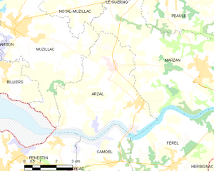
Arzal
- commune in Morbihan, France
- Country:
- Postal Code: 56190
- Coordinates: 47° 31' 0" N, 2° 22' 34" E
- GPS tracks (wikiloc): [Link]
- Area: 23.44 sq km
- Population: 1607
- Web site: [Link]


Noyal-Muzillac
- commune in Morbihan, France
- Country:
- Postal Code: 56190
- Coordinates: 47° 35' 30" N, 2° 27' 25" E
- GPS tracks (wikiloc): [Link]
- Area: 48.89 sq km
- Population: 2531
- Web site: [Link]

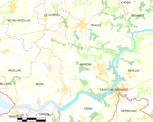
Marzan
- commune in Morbihan, France
- Country:
- Postal Code: 56130
- Coordinates: 47° 32' 27" N, 2° 19' 26" E
- GPS tracks (wikiloc): [Link]
- Area: 33.84 sq km
- Population: 2263
- Web site: [Link]