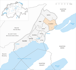
Neuchâtel District (Bezirk Neuenburg)
- former district in Switzerland
Hiking in the Neuchâtel District, located in the western part of Switzerland, offers a diverse range of trails and scenic views, making it an excellent destination for both casual walkers and experienced hikers. Here are some key highlights of hiking in this beautiful region:
Scenic Landscapes
The Neuchâtel District boasts a mix of landscapes, including rolling hills, picturesque lakes, and dense forests. The highlight is the stunning Lake Neuchâtel, the largest lake entirely within Switzerland, which provides beautiful lakeside trails and fantastic views of surrounding mountains.
Notable Hiking Areas
-
Creux du Van: This natural rock amphitheater is a must-visit. The hike to Creux du Van is popular and offers breathtaking panoramas. The route is well-marked and varies in difficulty, making it accessible for various skill levels.
-
Jura Mountains: The Jura range borders the district and provides numerous hiking opportunities. Trails in the Jura are well managed and offer beautiful vistas, with options for both day hikes and longer multi-day treks.
-
Lac de Neuchâtel: Walking along the shores of the lake can lead you to charming small towns like Neuchâtel, Auvernier, and Murten. The lakeside paths are ideal for a leisurely stroll or a more sustained hike.
Hiking Recommendations
- Trail Levels: The district offers trails for all experience levels. Beginners can enjoy flatter lakeside paths, while more experienced hikers can tackle mountainous terrain with steeper ascents.
- Marked Trails: The trails are well-marked in accordance with Swiss hiking standards. Many trails are accompanied by signposts that provide distance and estimated walking time.
- Seasonal Hiking: Spring and summer are particularly beautiful for hiking, as wildflowers bloom and temperatures are mild. Autumn offers stunning fall foliage, while winter hiking can be delightful in snowy areas, though ensure trails are open and safe.
Tips for Hiking
- Prepare: Always check the weather forecast and trail conditions before heading out. Carry a map and a fully charged phone for navigation.
- Equipment: Wear appropriate footwear (sturdy hiking boots recommended) and dress in layers to manage changes in temperature.
- Hydration & Snacks: Bring enough water and snacks, especially on longer hikes, as some areas may not have facilities.
- Respect Nature: Follow Leave No Trace principles to preserve the natural beauty of the area.
Local Culture and Attractions
While hiking, take the opportunity to explore local culture, including quaint villages, traditional Swiss cuisine in local restaurants, and historical sites in the Neuchâtel area.
Overall, hiking in the Neuchâtel District is a rewarding experience, offering beautiful scenery, varied hiking options, and a chance to immerse yourself in the Swiss outdoors.
- Country:

- Capital: Neuchâtel
- Licence Plate Code: NE
- Coordinates: 46° 59' 25" N, 6° 55' 50" E


- GPS tracks (wikiloc): [Link]
- AboveSeaLevel: 458 м m
- Area: 80.02 sq km
- Wikipedia en: wiki(en)
- Wikipedia: wiki(de)
- Wikidata storage: Wikidata: Q511990
- Wikipedia Commons Category: [Link]
- Freebase ID: [/m/0f_qlm]
- GeoNames ID: Alt: [6458886]
- VIAF ID: Alt: [242735308]
- GND ID: Alt: [4557634-8]
- archINFORM location ID: [42738]
Includes regions:


Enges
- municipality in Switzerland
Hiking in Enges, a picturesque area in Switzerland, offers a blend of stunning landscapes, rich nature, and well-maintained trails. The region is known for its rolling hills, lush forests, and breathtaking views of the surrounding mountains. Here are some key points to consider if you plan to hike in Enges:...
- Country:

- Postal Code: 2073
- Local Dialing Code: 032
- Licence Plate Code: NE
- Coordinates: 47° 4' 20" N, 7° 0' 43" E


- GPS tracks (wikiloc): [Link]
- AboveSeaLevel: 1077 м m
- Area: 9.59 sq km
- Population: 274
- Web site: [Link]


Lignières
- municipality in the canton of Neuchâtel, Switzerland
Lignières is a picturesque village located in the Neuchâtel region of Switzerland. It's a great starting point for hiking enthusiasts due to its scenic views, diverse terrain, and proximity to the Jura Mountains. Here are some highlights and suggestions for hiking in and around Lignières:...
- Country:

- Postal Code: 2523
- Local Dialing Code: 032
- Licence Plate Code: NE
- Coordinates: 47° 5' 0" N, 7° 4' 0" E


- GPS tracks (wikiloc): [Link]
- AboveSeaLevel: 802 м m
- Area: 12.51 sq km
- Population: 952
- Web site: [Link]


Neuchâtel
- city in Switzerland and capital of its canton
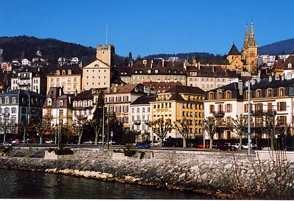
Hiking in Neuchâtel, located in the picturesque region of Switzerland, offers stunning landscapes, scenic lakes, and a variety of trails suitable for all levels of hikers. Here are some highlights to consider:...
- Country:

- Postal Code: 2000
- Local Dialing Code: 032
- Licence Plate Code: NE
- Coordinates: 46° 59' 25" N, 6° 55' 50" E


- GPS tracks (wikiloc): [Link]
- AboveSeaLevel: 434 м m
- Area: 18.05 sq km
- Population: 33772
- Web site: [Link]


Cressier
- municipality in the canton of Neuchâtel, Switzerland
Cressier, located in the Neuchâtel district of Switzerland, is a charming village surrounded by beautiful landscapes, making it a great destination for hiking enthusiasts. Here are some highlights and tips for hiking in and around Cressier:...
- Country:

- Postal Code: 2088
- Local Dialing Code: 032
- Licence Plate Code: NE
- Coordinates: 47° 3' 3" N, 7° 2' 8" E


- GPS tracks (wikiloc): [Link]
- AboveSeaLevel: 570 м m
- Area: 8.55 sq km
- Population: 1873
- Web site: [Link]


Le Landeron
- municipality of Switzerland
Le Landeron is a picturesque village located in the Neuchâtel region of Switzerland, nestled along the shores of Lake Neuchâtel. It offers a variety of hiking opportunities, characterized by beautiful landscapes, charming vineyards, and serene lakeside views. Here are some key points to consider if you're planning to hike in Le Landeron:...
- Country:

- Postal Code: 2525
- Local Dialing Code: 032
- Licence Plate Code: NE
- Coordinates: 47° 3' 19" N, 7° 4' 9" E


- GPS tracks (wikiloc): [Link]
- AboveSeaLevel: 575 м m
- Area: 10.31 sq km
- Population: 4647
- Web site: [Link]


La Tène
- municipality in the canton of Neuchâtel, Switzerland
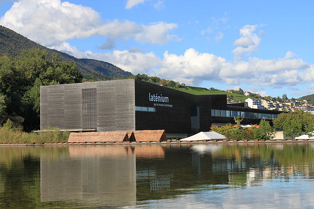
Hiking in La Tène, located near Neuchâtel in Switzerland, offers a beautiful blend of scenic landscapes, historical significance, and outdoor activities. La Tène is particularly known for its archaeological site, which dates back to the Iron Age and carries great cultural importance....
- Country:

- Postal Code: 2074
- Local Dialing Code: 032
- Licence Plate Code: NE
- Coordinates: 47° 0' 40" N, 7° 0' 20" E


- GPS tracks (wikiloc): [Link]
- AboveSeaLevel: 450 м m
- Area: 5.35 sq km
- Population: 4954
- Web site: [Link]
Saint-Blaise
- municipality in the canton of Neuchâtel, Switzerland
Saint-Blaise is a charming village located near the shores of Lake Neuchâtel in Switzerland, offering a variety of hiking opportunities that showcase the region's stunning natural beauty. Here are some highlights for hiking in and around Saint-Blaise:...
- Country:

- Postal Code: 2072
- Local Dialing Code: 032
- Licence Plate Code: NE
- Coordinates: 47° 0' 47" N, 6° 59' 11" E


- GPS tracks (wikiloc): [Link]
- AboveSeaLevel: 562 м m
- Area: 8.87 sq km
- Population: 3230
- Web site: [Link]


Hauterive
- municipality in the canton of Neuchâtel, Switzerland
Hauterive, located near Neuchâtel in Switzerland, offers beautiful hiking opportunities that showcase the picturesque landscapes of the region. The area is characterized by its stunning views of Lake Neuchâtel, rolling hills, vineyards, and lush forests. Here are some highlights and tips for hiking in Hauterive:...
- Country:

- Postal Code: 2068
- Local Dialing Code: 032
- Licence Plate Code: NE
- Coordinates: 47° 0' 47" N, 6° 58' 8" E


- GPS tracks (wikiloc): [Link]
- AboveSeaLevel: 518 м m
- Area: 2.07 sq km
- Population: 2650
- Web site: [Link]


Cornaux
- municipality in Switzerland
Cornaux is a picturesque village located in the Canton of Neuchâtel in Switzerland, surrounded by beautiful natural landscapes, making it an excellent destination for hiking enthusiasts. Here are some highlights and tips for hiking in and around Cornaux:...
- Country:

- Postal Code: 2087
- Local Dialing Code: 032
- Licence Plate Code: NE
- Coordinates: 47° 1' 59" N, 7° 1' 3" E


- GPS tracks (wikiloc): [Link]
- AboveSeaLevel: 429 м m
- Area: 4.72 sq km
- Population: 1586
- Web site: [Link]

