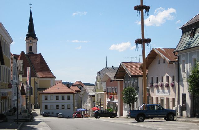
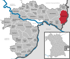
Neustift im Mühlkreis (Neustift im Mühlkreis)
- municipality in Austria
 Hiking in Neustift im Mühlkreis
Neustift im Mühlkreis, located in the picturesque Mühlviertel region of Austria, offers a variety of hiking opportunities that cater to all levels of hikers. This area is known for its beautiful natural landscapes, rolling hills, dense forests, and stunning views of the surrounding countryside.
Hiking Trails
-
Local Trails: There are numerous marked hiking trails in and around Neustift that showcase the scenic beauty of the region. These trails vary in difficulty and length, so you can choose one that suits your fitness level and interests.
-
Regional Hiking Networks: The Mühlviertel region has a well-maintained network of hiking paths, including themed trails that provide insights into local flora, fauna, and history. Look for routes such as the “Mühlviertler Weitwanderweg” which offers longer hikes for those looking for a more adventurous experience.
-
Forested Areas: Much of the hiking in this area goes through dense woodlands and hills, providing a tranquil atmosphere and opportunities for wildlife spotting. The region is home to various species of birds, deer, and other forest animals.
Tips for Hiking in Neustift im Mühlkreis
- Seasonal Considerations: Late spring, summer, and early autumn are ideal for hiking, as the weather is typically mild and the landscapes are lush. Winter hiking is also possible; just be sure to check trail conditions and dress appropriately.
- Equipment: Good hiking boots and weather-appropriate clothing are essential. Carry enough water, snacks, and a first aid kit. A map or GPS device can help navigate the trails.
- Local Amenities: Neustift im Mühlkreis has facilities for visitors, including accommodations and local eateries where you can enjoy traditional Austrian cuisine after a long hike.
Conclusion
Whether you prefer a leisurely stroll through the woods or a challenging hike to panoramic viewpoints, Neustift im Mühlkreis has something to offer. Always remember to respect nature, stay on marked trails, and leave no trace behind to preserve the beauty of this stunning region for future hikers. Enjoy your adventure!
- Country:

- Postal Code: 4143
- Local Dialing Code: 07284
- Licence Plate Code: RO
- Coordinates: 48° 31' 44" N, 13° 45' 22" E


- GPS tracks (wikiloc): [Link]
- AboveSeaLevel: 591 м m
- Area: 20 sq km
- Population: 1461
- Web site: http://www.neustift-muehlviertel.at/
- Wikipedia en: wiki(en)
- Wikipedia: wiki(de)
- Wikidata storage: Wikidata: Q693573
- Wikipedia Commons Category: [Link]
- Freebase ID: [/m/03gvb2m]
- GeoNames ID: Alt: [7873202]
- VIAF ID: Alt: [245864942]
- Austrian municipality key: [41329]
Shares border with regions:

Untergriesbach
- municipality of Germany
Hiking in Untergriesbach
Untergriesbach, located in Bavaria, Germany, is a charming area surrounded by beautiful natural landscapes, making it an excellent destination for hiking enthusiasts. Here are some key points about hiking in and around Untergriesbach:...
- Country:

- Postal Code: 94107; W-8391; 8391
- Local Dialing Code: 08593
- Licence Plate Code: PA
- Coordinates: 48° 34' 25" N, 13° 40' 2" E
- GPS tracks (wikiloc): [Link]
- AboveSeaLevel: 556 м m
- Area: 73.61 sq km
- Population: 5814
- Web site: [Link]

Wegscheid
- municipality of Germany
Hiking in Wegscheid
Wegscheid, located in Bavaria, Germany, is a charming destination for hiking enthusiasts. The area is characterized by its picturesque landscapes, including rolling hills, lush forests, and panoramic views of the surrounding region. Here are some highlights and tips for hiking in Wegscheid:...
- Country:
- Postal Code: 94110; W-8396; 8396
- Local Dialing Code: 08592
- Coordinates: 48° 36' 0" N, 13° 47' 0" E
- GPS tracks (wikiloc): [Link]
- AboveSeaLevel: 718 м m
- Area: 80.64 sq km
- Population: 5393
- Web site: [Link]

Pfarrkirchen im Mühlkreis
- municipality in Austria
Hiking in Pfarrkirchen im Mühlkreis
Pfarrkirchen im Mühlkreis, located in Austria's Upper Austria region, is a wonderful destination for hiking enthusiasts. Surrounded by picturesque landscapes, rolling hills, and lush forests, the area offers numerous trails catering to all levels of hikers, from beginners to seasoned trekkers....
- Country:
- Postal Code: 4141
- Local Dialing Code: 07285
- Licence Plate Code: RO
- Coordinates: 48° 30' 16" N, 13° 49' 32" E
- GPS tracks (wikiloc): [Link]
- AboveSeaLevel: 819 м m
- Area: 31 sq km
- Population: 1474
- Web site: [Link]

Engelhartszell an der Donau
- municipality in Austria
Hiking in Engelhartszell an der Donau
Engelhartszell an der Donau, located in the Austrian region of Upper Austria, is a charming destination for hikers and nature enthusiasts. It’s nestled along the banks of the Danube River and offers a variety of scenic trails that showcase the natural beauty of the area....
- Country:
- Postal Code: 4090
- Local Dialing Code: 07717
- Licence Plate Code: SD
- Coordinates: 48° 30' 0" N, 13° 44' 0" E
- GPS tracks (wikiloc): [Link]
- AboveSeaLevel: 302 м m
- Area: 19 sq km
- Population: 942
- Web site: [Link]

Niederwaldkirchen
- municipality in Austria
Hiking in Niederwaldkirchen
Niederwaldkirchen, located in Austria's Upper Austria region, offers beautiful hiking opportunities that cater to a range of skill levels. The area's scenic landscapes feature rolling hills, lush forests, and panoramic views of the surrounding countryside, making it an ideal destination for nature lovers and outdoor enthusiasts....
- Country:
- Postal Code: 4174
- Local Dialing Code: 07231
- Licence Plate Code: RO
- Coordinates: 48° 27' 5" N, 14° 5' 8" E
- GPS tracks (wikiloc): [Link]
- AboveSeaLevel: 525 м m
- Area: 28 sq km
- Population: 1816
- Web site: [Link]

Hofkirchen im Mühlkreis
- municipality in Austria
Hiking in Hofkirchen im Mühlkreis
Hofkirchen im Mühlkreis, located in Upper Austria, is a beautiful area offering a variety of hiking opportunities. It's surrounded by picturesque landscapes, rolling hills, and lush forests, making it a great destination for both novice and experienced hikers....
- Country:
- Postal Code: 4142
- Local Dialing Code: 07285
- Licence Plate Code: RO
- Coordinates: 48° 29' 2" N, 13° 48' 43" E
- GPS tracks (wikiloc): [Link]
- AboveSeaLevel: 601 м m
- Area: 23 sq km
- Population: 1520
- Web site: [Link]