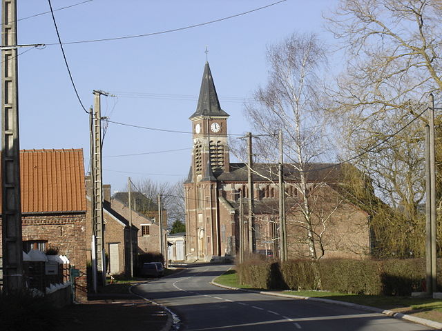
Oisy (Oisy)
- commune in Aisne, France
- Country:

- Postal Code: 02450
- Coordinates: 50° 1' 16" N, 3° 40' 10" E


- GPS tracks (wikiloc): [Link]
- Area: 10.79 sq km
- Population: 467
- Wikipedia en: wiki(en)
- Wikipedia: wiki(fr)
- Wikidata storage: Wikidata: Q742695
- Wikipedia Commons Category: [Link]
- Freebase ID: [/m/03m4gb2]
- Freebase ID: [/m/03m4gb2]
- GeoNames ID: Alt: [6425118]
- GeoNames ID: Alt: [6425118]
- SIREN number: [210205464]
- SIREN number: [210205464]
- PACTOLS thesaurus ID: [pcrtrtDd9Kw168]
- PACTOLS thesaurus ID: [pcrtrtDd9Kw168]
- INSEE municipality code: 02569
- INSEE municipality code: 02569
Shares border with regions:

Étreux
- commune in Aisne, France
- Country:

- Postal Code: 02510
- Coordinates: 49° 59' 39" N, 3° 39' 25" E


- GPS tracks (wikiloc): [Link]
- Area: 10.36 sq km
- Population: 1482
- Web site: [Link]


Rejet-de-Beaulieu
- commune in Nord, France
- Country:

- Postal Code: 59360
- Coordinates: 50° 2' 32" N, 3° 37' 54" E


- GPS tracks (wikiloc): [Link]
- Area: 6.35 sq km
- Population: 267


Mazinghien
- commune in Nord, France
- Country:

- Postal Code: 59360
- Coordinates: 50° 2' 59" N, 3° 36' 13" E


- GPS tracks (wikiloc): [Link]
- Area: 9.01 sq km
- Population: 308

Fesmy-le-Sart
- commune in Aisne, France
- Country:

- Postal Code: 02450
- Coordinates: 50° 2' 0" N, 3° 40' 0" E


- GPS tracks (wikiloc): [Link]
- AboveSeaLevel: 150 м m
- Area: 16.06 sq km
- Population: 497
- Web site: [Link]

Wassigny
- commune in Aisne, France
- Country:

- Postal Code: 02630
- Coordinates: 50° 0' 47" N, 3° 36' 0" E


- GPS tracks (wikiloc): [Link]
- Area: 6.79 sq km
- Population: 971
Bergues-sur-Sambre
- commune in Aisne, France
- Country:

- Postal Code: 02450
- Coordinates: 50° 2' 0" N, 3° 42' 21" E


- GPS tracks (wikiloc): [Link]
- Area: 4.41 sq km
- Population: 211

Boué
- commune in Aisne, France
- Country:

- Postal Code: 02450
- Coordinates: 50° 0' 43" N, 3° 41' 55" E


- GPS tracks (wikiloc): [Link]
- Area: 10.44 sq km
- Population: 1303