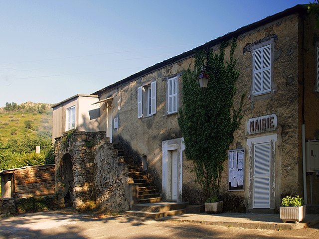
Oletta (Oletta)

- commune in Haute-Corse, France
- Country:

- Postal Code: 20232
- Coordinates: 42° 37' 57" N, 9° 21' 20" E


- GPS tracks (wikiloc): [Link]
- AboveSeaLevel: 250 м m
- Area: 26.61 sq km
- Population: 1650
- Web site: http://www.oletta.corse.fr/
- Wikipedia en: wiki(en)
- Wikipedia: wiki(fr)
- Wikidata storage: Wikidata: Q650588
- Wikipedia Commons Category: [Link]
- Freebase ID: [/m/03nswkm]
- Freebase ID: [/m/03nswkm]
- GeoNames ID: Alt: [2989625]
- GeoNames ID: Alt: [2989625]
- SIREN number: [212001853]
- SIREN number: [212001853]
- BnF ID: [152501684]
- BnF ID: [152501684]
- VIAF ID: Alt: [167559584]
- VIAF ID: Alt: [167559584]
- Library of Congress authority ID: Alt: [n2003032038]
- Library of Congress authority ID: Alt: [n2003032038]
- WOEID: [614906]
- WOEID: [614906]
- INSEE municipality code: 2B185
- INSEE municipality code: 2B185
Shares border with regions:


Poggio-d'Oletta
- commune in Haute-Corse, France
- Country:
- Postal Code: 20232
- Coordinates: 42° 38' 22" N, 9° 21' 45" E
- GPS tracks (wikiloc): [Link]
- AboveSeaLevel: 350 м m
- Area: 16.16 sq km
- Population: 214

Rapale
- commune in Haute-Corse, France
- Country:
- Postal Code: 20258
- Coordinates: 42° 35' 27" N, 9° 18' 13" E
- GPS tracks (wikiloc): [Link]
- AboveSeaLevel: 400 м m
- Area: 10.16 sq km
- Population: 150


Biguglia
- commune in Haute-Corse, France
- Country:
- Postal Code: 20620
- Coordinates: 42° 37' 6" N, 9° 26' 10" E
- GPS tracks (wikiloc): [Link]
- AboveSeaLevel: 270 м m
- Area: 22.27 sq km
- Population: 7957
- Web site: [Link]


Furiani
- commune in Haute-Corse, France
- Country:
- Postal Code: 20600
- Coordinates: 42° 39' 24" N, 9° 25' 59" E
- GPS tracks (wikiloc): [Link]
- AboveSeaLevel: 150 м m
- Area: 18.49 sq km
- Population: 5736
- Web site: [Link]


Saint-Florent
- commune in Haute-Corse, France
- Country:
- Postal Code: 20217
- Coordinates: 42° 40' 51" N, 9° 18' 9" E
- GPS tracks (wikiloc): [Link]
- AboveSeaLevel: 10 м m
- Area: 17.98 sq km
- Population: 1604

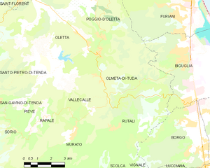
Olmeta-di-Tuda
- commune in Haute-Corse, France
- Country:
- Postal Code: 20232
- Coordinates: 42° 36' 41" N, 9° 21' 14" E
- GPS tracks (wikiloc): [Link]
- AboveSeaLevel: 300 м m
- Area: 17.4 sq km
- Population: 435