Orbec (Orbec)

- commune in Calvados, France
- Country:

- Postal Code: 14290
- Coordinates: 49° 1' 18" N, 0° 24' 24" E


- GPS tracks (wikiloc): [Link]
- AboveSeaLevel: 110 м m
- Area: 10.14 sq km
- Population: 2152
- Web site: http://www.mairie-orbec.fr
- Wikipedia en: wiki(en)
- Wikipedia: wiki(fr)
- Wikidata storage: Wikidata: Q328304
- Wikipedia Commons Category: [Link]
- Freebase ID: [/m/031ptd]
- Freebase ID: [/m/031ptd]
- GeoNames ID: Alt: [6615908]
- GeoNames ID: Alt: [6615908]
- SIREN number: [211404785]
- SIREN number: [211404785]
- BnF ID: [15247889h]
- BnF ID: [15247889h]
- VIAF ID: Alt: [244174769]
- VIAF ID: Alt: [244174769]
- GND ID: Alt: [4243252-2]
- GND ID: Alt: [4243252-2]
- archINFORM location ID: [45582]
- archINFORM location ID: [45582]
- PACTOLS thesaurus ID: [pcrt0jlz229OR9]
- PACTOLS thesaurus ID: [pcrt0jlz229OR9]
- INSEE municipality code: 14478
- INSEE municipality code: 14478
Shares border with regions:


La Vespière
- former commune in Calvados, France
- Country:
- Postal Code: 14290
- Coordinates: 49° 1' 7" N, 0° 24' 44" E
- GPS tracks (wikiloc): [Link]
- Area: 8.65 sq km
- Population: 977


Saint-Germain-la-Campagne
- commune in Eure, France
- Country:
- Postal Code: 27230
- Coordinates: 49° 2' 54" N, 0° 24' 20" E
- GPS tracks (wikiloc): [Link]
- Area: 22.23 sq km
- Population: 886


Saint-Martin-de-Bienfaite-la-Cressonnière
- commune in Calvados, France
- Country:
- Postal Code: 14290
- Coordinates: 49° 2' 43" N, 0° 21' 44" E
- GPS tracks (wikiloc): [Link]
- AboveSeaLevel: 100 м m
- Area: 11.55 sq km
- Population: 487


Friardel
- former commune in Calvados, France
- Country:
- Postal Code: 14290
- Coordinates: 49° 0' 1" N, 0° 23' 19" E
- GPS tracks (wikiloc): [Link]
- Area: 9.39 sq km
- Population: 242

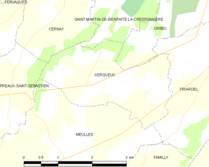
Cerqueux
- former commune in Calvados, France
- Country:
- Postal Code: 14290
- Coordinates: 48° 59' 39" N, 0° 21' 47" E
- GPS tracks (wikiloc): [Link]
- Area: 5.66 sq km
- Population: 99