
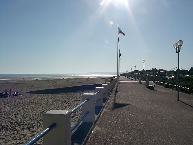
Ouistreham (Ouistreham)

- commune in Calvados, France
- Country:

- Postal Code: 14150
- Coordinates: 49° 16' 45" N, 0° 15' 30" E


- GPS tracks (wikiloc): [Link]
- AboveSeaLevel: 12 м m
- Area: 9.95 sq km
- Population: 9177
- Web site: https://ouistreham-rivabella.fr/
- Wikipedia en: wiki(en)
- Wikipedia: wiki(fr)
- Wikidata storage: Wikidata: Q274825
- Wikipedia Commons Category: [Link]
- Freebase ID: [/m/031q2q]
- Freebase ID: [/m/031q2q]
- GeoNames ID: Alt: [2989013]
- GeoNames ID: Alt: [2989013]
- SIREN number: [211404884]
- SIREN number: [211404884]
- BnF ID: [15247898g]
- BnF ID: [15247898g]
- VIAF ID: Alt: [248705415]
- VIAF ID: Alt: [248705415]
- GND ID: Alt: [4389934-1]
- GND ID: Alt: [4389934-1]
- Quora topic ID: [Ouistreham]
- Quora topic ID: [Ouistreham]
- Encyclopædia Britannica Online ID: [place/Ouistreham]
- Encyclopædia Britannica Online ID: [place/Ouistreham]
- Twitter username: Alt: [OuistrehamRB]
- Twitter username: Alt: [OuistrehamRB]
- INSEE municipality code: 14488
- INSEE municipality code: 14488
Shares border with regions:


Saint-Aubin-d'Arquenay
- commune in Calvados, France
- Country:
- Postal Code: 14970
- Coordinates: 49° 15' 44" N, 0° 17' 19" E
- GPS tracks (wikiloc): [Link]
- Area: 3.29 sq km
- Population: 873
- Web site: [Link]


Ranville
- commune in Calvados, France
- Country:
- Postal Code: 14860
- Coordinates: 49° 13' 52" N, 0° 15' 27" E
- GPS tracks (wikiloc): [Link]
- Area: 8.42 sq km
- Population: 1776
- Web site: [Link]


Bénouville
- commune in Calvados, France
- Country:
- Postal Code: 14970
- Coordinates: 49° 14' 28" N, 0° 16' 47" E
- GPS tracks (wikiloc): [Link]
- Area: 5.28 sq km
- Population: 2099
- Web site: [Link]

Merville-Franceville-Plage
- commune in Calvados, France
- Country:
- Postal Code: 14810
- Coordinates: 49° 16' 41" N, 0° 12' 12" E
- GPS tracks (wikiloc): [Link]
- AboveSeaLevel: 14 м m
- Area: 10.42 sq km
- Population: 2184
- Web site: [Link]


Sallenelles
- commune in Calvados, France
- Country:
- Postal Code: 14121
- Coordinates: 49° 15' 50" N, 0° 13' 45" E
- GPS tracks (wikiloc): [Link]
- Area: 1.25 sq km
- Population: 304
- Web site: [Link]


Amfreville
- commune in Calvados, France
- Country:
- Postal Code: 14860
- Coordinates: 49° 14' 54" N, 0° 14' 3" E
- GPS tracks (wikiloc): [Link]
- Area: 6.06 sq km
- Population: 1414
- Web site: [Link]


Colleville-Montgomery
- commune in Calvados, France
- Country:
- Postal Code: 14880
- Coordinates: 49° 16' 28" N, 0° 18' 1" E
- GPS tracks (wikiloc): [Link]
- Area: 7.74 sq km
- Population: 2371
- Web site: [Link]