Péault (Péault)

- commune in Vendée, France
- Country:

- Postal Code: 85320
- Coordinates: 46° 30' 7" N, 1° 13' 14" E


- GPS tracks (wikiloc): [Link]
- Area: 9.09 sq km
- Population: 592
- Web site: https://www.peault.fr/
- Wikipedia en: wiki(en)
- Wikipedia: wiki(fr)
- Wikidata storage: Wikidata: Q682259
- Wikipedia Commons Category: [Link]
- Freebase ID: [/m/03qhkgm]
- GeoNames ID: Alt: [2988267]
- SIREN number: [218501716]
- BnF ID: [15278297b]
- Twitter username: Alt: [Peault85]
- INSEE municipality code: 85171
Shares border with regions:

La Bretonnière-la-Claye
- commune in Vendée, France
- Country:
- Postal Code: 85320
- Coordinates: 46° 28' 59" N, 1° 15' 22" E
- GPS tracks (wikiloc): [Link]
- Area: 16.48 sq km
- Population: 589


Corpe
- commune in Vendée, France
- Country:
- Postal Code: 85320
- Coordinates: 46° 30' 19" N, 1° 10' 56" E
- GPS tracks (wikiloc): [Link]
- Area: 17.1 sq km
- Population: 1070

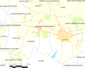
Les Magnils-Reigniers
- commune in Vendée, France
- Country:
- Postal Code: 85400
- Coordinates: 46° 28' 44" N, 1° 13' 13" E
- GPS tracks (wikiloc): [Link]
- AboveSeaLevel: 12 м m
- Area: 17.96 sq km
- Population: 1609
- Web site: [Link]

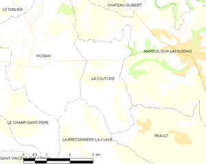
La Couture
- commune in Vendée, France
- Country:
- Postal Code: 85320
- Coordinates: 46° 31' 15" N, 1° 15' 50" E
- GPS tracks (wikiloc): [Link]
- Area: 7.03 sq km
- Population: 214
- Web site: [Link]
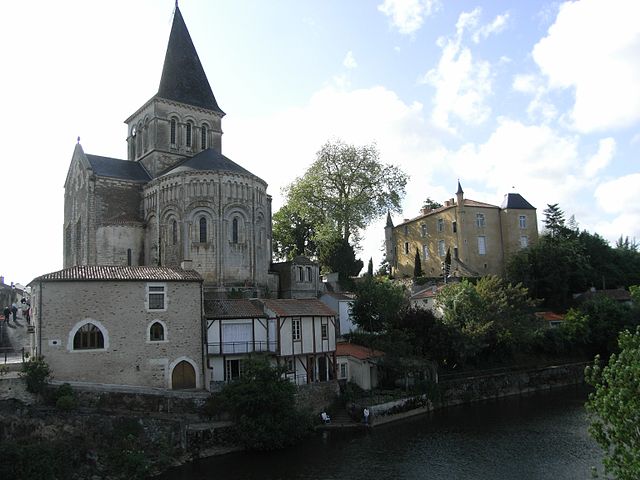

Mareuil-sur-Lay-Dissais
- commune in Vendée, France
- Country:
- Postal Code: 85320
- Coordinates: 46° 32' 4" N, 1° 13' 4" E
- GPS tracks (wikiloc): [Link]
- AboveSeaLevel: 23 м m
- Area: 25.65 sq km
- Population: 2806
- Web site: [Link]